
mundialis auf dem Bonner Firmenlauf 2024
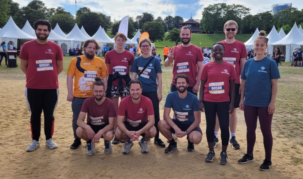
Über 10.000 Teilnehmende haben am 13. Juni bei strahlendem Wetter am 16. Bonner Firmenlauf teilgenommen, veranstaltet durch Weis Events GmbH. Gemeinsam mit den Kollegen:innen von terrestris sind wir dieses Jahr wieder die 5,7 km lange Strecke durch die Bonner Rheinaue gelaufen. Bei bester Stimmung auf und neben der Laufstrecke sind alle gut durchs Ziel gekommen. ☀️Außerdem kamen […]
Transformationspotenziale großer Parkflächen für den nachhaltigen Stadtumbau
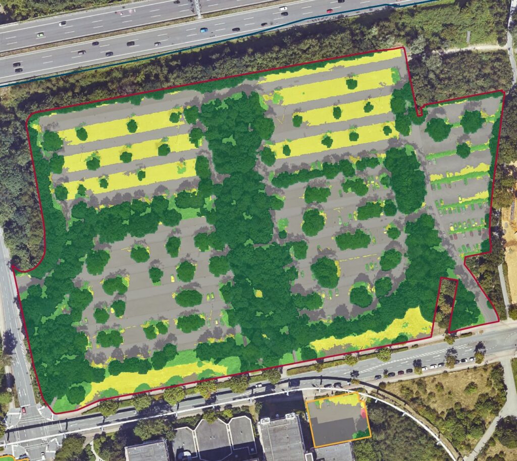
Welche Rolle spielen Parkplätze bei der Aufwertung unserer Städte? Wie können diese transformiert werden, um das Stadtbild moderner, ökologischer und zukunftsweisend zu machen? Das ist Gegenstand des Forschungsprojektes “Transformationspotenziale großflächiger Parkplätze für den nachhaltigen Stadtumbau”. Mit den drei Modellkommunen Dortmund, Görlitz und Ulm werden aufbauend auf einer umfassenden Analyse der Parkplätze im Stadtgebiet verschiedene Transformationskonzepte […]
News zu CO₂e Kompensierung bei mundialis für 2021 und 2022
Im Rahmen unseres Umweltmanagementsystems und der ISO 19001 Zertifizierung, die wir Ende 2023 erhalten haben, möchten wir Umweltbelastungen die durch Reisetätigkeiten entstanden sind, auf ein Minimum reduzieren. Die aufgrund von Firmen-Mobilität ausgestoßene CO₂e-Menge soll am Jahresanfang für das zurückliegende Jahr kompensiert werden Da sich das Umweltmanagementsystem im letzten Jahr noch im Aufbau befunden hat, erfolgte […]
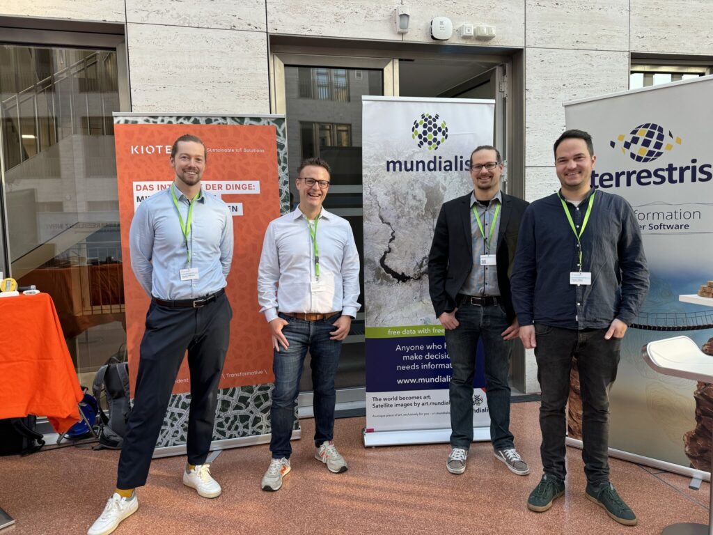
FOSSGIS 2024
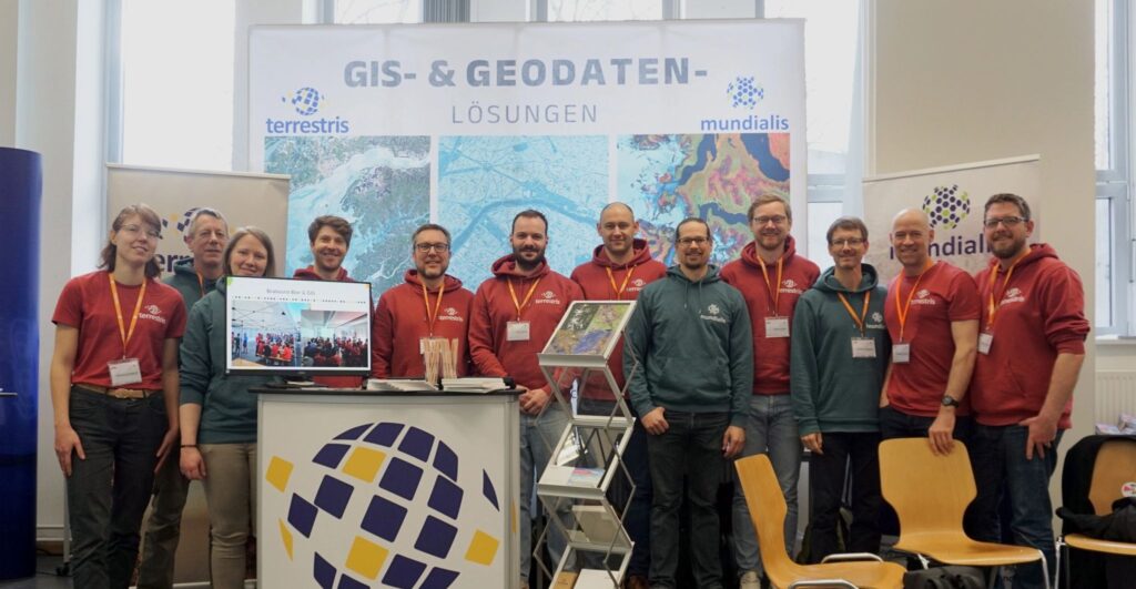
Wir freuen uns, Teil der 21. FOSSGIS-Konferenz vom 20.-23. März 2024 in Hamburg gewesen zu sein. Die Veranstaltung stellt Freie und Open Source Software für Geoinformationssysteme sowie für die Themen Open Data und OpenStreetMap in den Mittelpunkt. An dem gemeinsamen Stand mit unseren Kolleg:innen von terrestris sind spannende Gespräche entstanden. Wir möchten uns herzlich über […]
Willkommen beim Katalog der deutschen Raumfahrtakteure
Willkommen beim Katalog der deutschen Raumfahrtakteure! So heißt es nun auch für mundialis GmbH & Co. KG!Wir sind als Akteur im neu erstellten Katalog der deutschen Raumfahrtakteure des Deutsches Zentrum für Luft-und Raumfahrt e.V. aufgenommen worden. Wir werden dort unter den Rubriken „Raumfahrtbasierte Anwendungen“ und „Erdbeobachtung“ geführt. Dies unterstreicht unsere Rolle in den fernerkundlichen Erd- und […]
Forum Klimaresilienz NRW’24
Der Klimawandel ist nicht nur etwas, was sich irgendwo anders abspielt. Sondern auch genau hier bei uns in NRW spielt sich Klimawandel ab.Um die Gesellschaft widerstandsfähiger gegenüber den Klimafolgen zu machen veranstaltete das Umweltminusterium NRW durch das Netzwerk Klimaanpassung und Unternehmen.NRW das FORUM KLIMARESILIENZ NRW’24. Wir sind überzeugt, dass Innovation und Zusammenarbeit zwischen der öffentlichen Hand und […]
Zertifiziertes Qualitäts- und Umweltmanagment bei mundialis und terrestris
Im Jahr 2023 war es ein vorrangiges Ziel von mundialis und unserem Schwesterunternehmen terrestris, eine erfolgreiche Zertifizierung unserer jeweiligen Qualitäts- und Umweltmanagementsysteme gemäß der Standards DIN EN ISO 9001:2015 und DIN EN ISO 14001:2015 zu erreichen. Wir freuen uns, mitteilen zu können, dass unsere diesbezüglichen Anstrengungen von Erfolg gekrönt waren und wir seit Dezember 2023 […]
Unsere neue Webseite ist online
Free Data With Free Software Was lange währt wird endlich live – unter unserem Motte „Free data with free software“ ist seit letzter Woche nun endlich unsere neue Webseite – diese Seite, die ihr liebe Leser aktuell vor Augen habt – live! Viel Arbeit, Schweiß und unzählige Stunden und Gedanken sind in die Konzeption und […]
terrestris & mundialis auf großer Klausurtagung – eine spannende und intensive Woche
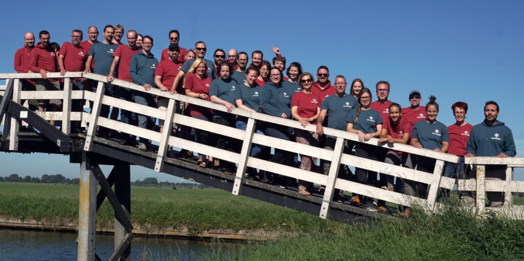
Nach 2 Jahren war es nun endlich wieder soweit: Gemeinsam mit unserer Schwesterfirma terrestris GmbH & Co. KG war die mundialis GmbH & Co. KG in der ersten Septemberwoche auf unserer regelmäßig stattfindenden, einwöchigen Klausurtagung. Dieses Jahr in Spanbroek, Niederlande (siehe auch unser Satellitenbild des Monat September ). Bei traumhaftem Wetter wurde sieben Tage am Stück gemeinsam in […]
mundialis auf dem Bonner Firmenlauf
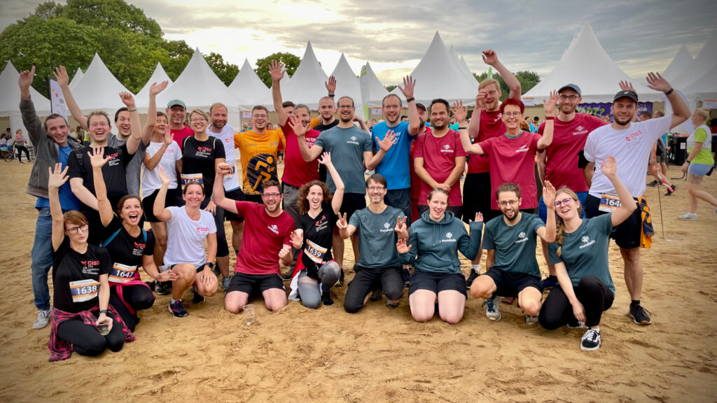
Über 10.000 Teilnehmende haben am 24. August bei wechselhaftem Wetter, aber mit bester Laune am 15. Bonner Firmenlauf veranstaltet durch Weis Events GmbH teilgenommen. Wir von mundialis GmbH & Co. KG haben gemeinsam mit den Kollegen:innen von terrestris GmbH & Co. KG und der CISS TDI GmbH mit über 40 Teilnehmenden auf die 5,7 km lange Strecke […]