Monitoring of the Irish state forest

Forest monitoring using vegetation indices based on Sentinel-2 data.

Challenge

Satellites can provide information on the composition of tree species and the age structure of forests for forest inventories, which benefits the sustainable management of forests. Nature reserves and protected areas can be monitored and protected from unauthorized activities using satellites. To support the Irish forest authority Coillte, mundialis developed a forest monitoring system based on Sentinel-2 to address some of these aspects.

Services

mundialis has fully implemented the routine forest cover monitoring service project. The implementation took place in the following work steps:

  • Download of Sentinel-2 (S2) L2A scenes over Ireland on a quarterly basis for a selected analysis period. The L2A scenes were provided by ESA processed with the atmospheric correction of sen2cor.
  • Post-processing of the S2 scene: reprojection and creation of a space-time data cube.
  • Cloud cover: combination of cloud masks provided by ESA and cloud masking developed by mundialis, masking the S2 scenes to cloud-free areas for further calculations, adding an attribute about the cloud cover level for the forest vector polygons provided by Coillte.
  • Zonal statistics: Calculation of NDVI, EVI and calculation of the median value for the forest vector polygons. The zone statistics are saved as attributes of the forest vector polygons.
  • Detection of changes based on a time series analysis (difference formation) of the median of NDVI and EVI. The results of the change detection are also saved as attributes of the forest vector polygons. Significant changes are determined via a manually adjustable limit value and saved as an additional attribute.
  • Identification of relevant S2 scenes related to detected significant changes (forest polygons) and preparation for the provision of NDVI and EVI raster maps derived from S2 scenes. These maps are relevant to enable a more detailed (visual) inspection of forest polygons with forest changes.
Result
  • Raster data: Cloud-optimized GeoTIFF files (COG)
    • The raster files were created as multi-band files and contain the various quarterly results as bands. This creates a stack of grid cards.
  • Vector data: Geopackage file (GPKG).
    • The vector files were created as multi-layered files containing the various quarterly results as layers. This creates a stack of vector cards.
  • The files (COG and GPKG) have been provided and can easily be extended by further bands/levels under the same file name for further quarters. This simplifies access and data processing for different users.
Customer
Coillte Cuideachta Ghníomhaíochta Ainmnithe, Newtownmountkennedy

Story

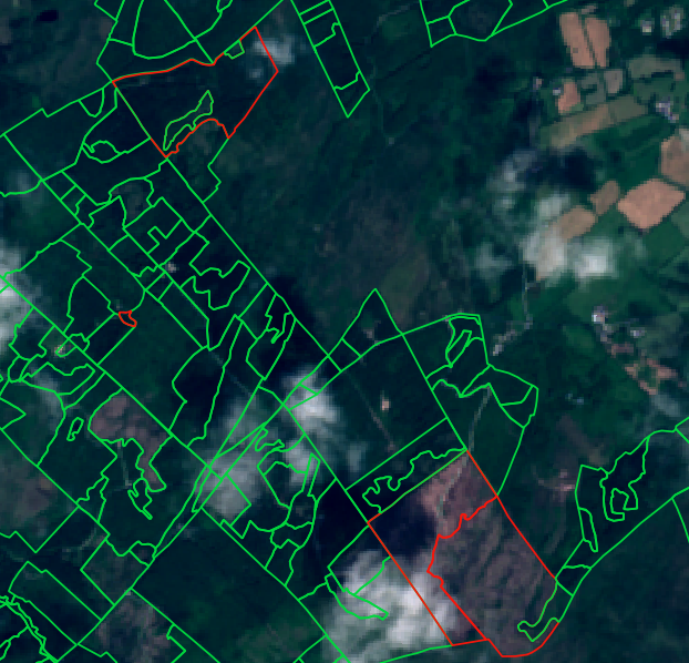
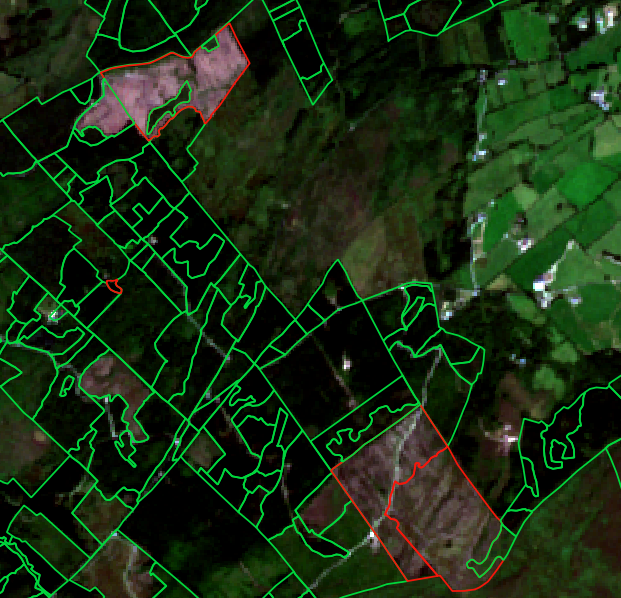
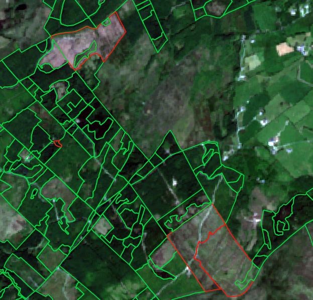
Continuous forest monitoring of an entire national forest using satellite data covers a wide range of tasks that help to monitor, protect and sustainably manage forests worldwide. The identification of deforestation activities is particularly important here. Satellite images make it possible to identify areas where trees are being illegally felled or forests cleared. Satellite images continue to help track changes in land use. This includes not only deforestation, but also agriculture, urbanization and infrastructure projects that have an impact on forests. The condition and health of forests can also be monitored in this way. This includes the detection of diseases, pests and natural disturbances such as forest fires.

terrestris