Unlock Historical Satellite Imagery for Archaeological Research
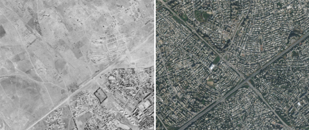
Our team has developed an innovative solution for processing declassified CORONA spy satellite imagery (1960-1972), providing unprecedented access to high-resolution historical landscape data with up to 60cm pixel resolution. This technology is particularly valuable for archaeological site identification and landscape change analysis.
Key features of our service include:
- Processing of original Keyhole spy satellite data
- Specialized handling of CORONA satellite imagery
- Advanced Orthorectification using proprietary mathematical modeling
- Professional image equalization for optimal clarity

These historic images provide a unique window into the past, capturing landscape features that may have been altered or destroyed over the last 50+ years. Our processing service transforms raw CORONA scans into precisely georeferenced data suitable for modern GIS analysis.
For archaeological research this means:
- Access to pre-development landscape imagery
- Identification of previously unknown archaeological features
- Documenting site degradation over time
- Integration with modern remote sensing data
Contact us for more information!
Would you like to know more about how this service could benefit your research? We would be happy to provide sample datasets or discuss specific applications for your region of interest.
