
FOSS4G 2022 in “La Bella” – Greetings from Florence!
After the cancellation of the FOSS4G in Calgary in 2020 due to Corona and the online FOSS4G conference from Buenos Aires in 2021, this year’s FOSS4G conference will finally take place again in presence and, after Bucharest 2019, again in Europe. The organising city of Florence on the Arno, nicknamed “La Bella” in Italy, also […]
VALE project successfully completed
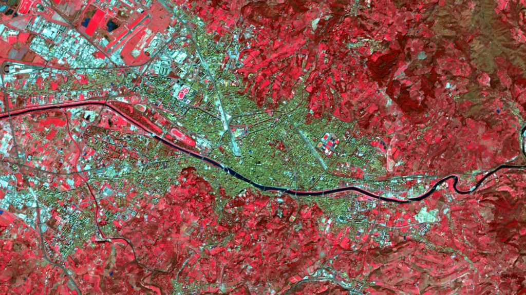
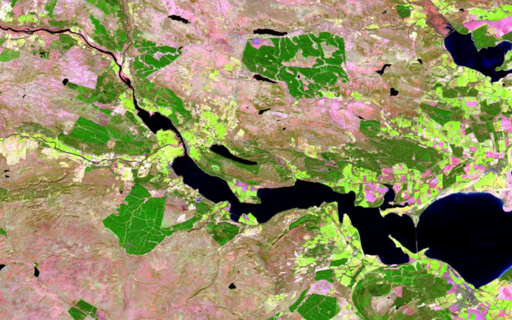
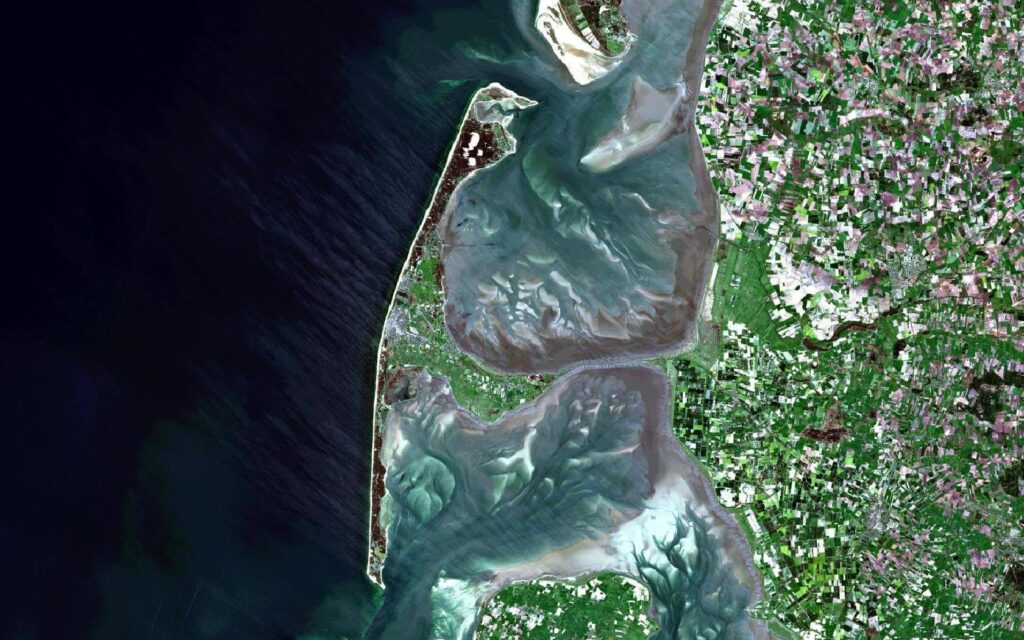
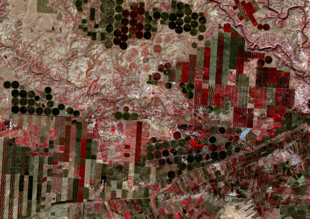
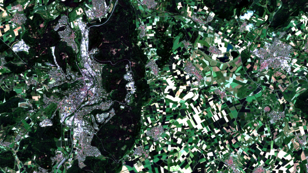
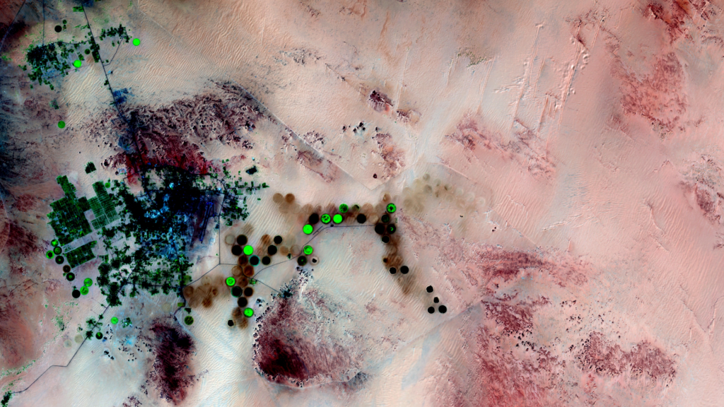
Our presentations at the Living Planet Symposium 2022 also represent the successful completion of the VALE project (Development and VALidation of earth observation-based indicators for the monitoring of the Sendai framework using the example of flooding in Ecuador). Together with our partners from United Nations University we explored how remote sensing data can be used […]
Taking part in ESA’s Earth Observation conference / A look back on the LPS 2022
How can the causes and impacts of natural disasters be monitored? What can remote sensing contribute to food security? And how can the large volumes of satellite data be processed and analysed as automatically as possible? These were just a few of the many issues addressed last week at the ESA Living Planet Symposium (LPS), […]
Presenting at the ESA Living Planet Symposium 2022
The ESA Living Planet Symposium “focuses on how Earth observation contributes to science and society, and how disruptive technologies and actors are changing the traditional Earth observation landscape” (quote from the website). Since this conference will take place from 23-27 May 2022 in the World Conference Center Bonn, practically on our doorstep, we obviously applied […]
Le Kollektiv – Meeting in Bonn
Le Kollektiv is a formal network of 9 European Digital and New Space companies founded in July 2021 in Paris and coordinated by Prométhée, a French New Space start-up specializing in end-to-end Earth observation services. Le Kollektiv is convinced that the future of New Space goes through digitalization. Therefore, besides Prométhée and mundialis, the partners […]
MOOD Science Webinar on COVID-19 Scatterplots
As part of the EU Horizon 2020 MOOD project (MOnitoring Outbreaks for Disease surveillance in a data science context), mundialis was invited to speak at the MOOD Science Webinar in February. The MOOD project aims to develop innovative tools and services for the early detection, assessment, and monitoring of current and future infectious disease threats […]
Update of actinia.mundialis.de to new API version 3
Until now, API version 1 was installed at actinia.mundialis.de. This was evident from the URL, e.g. https://actinia.mundialis.de/api/v1/version. Due to some updates, the current API version is now v3. actinia.mundialis.de is now updated to include the latest developments. Officially, actinia is thus accessible at https://actinia.mundialis.de/api/v3/version. In order not to break with existing user behavior / client […]
Ein Rückblick auf die FOSSGIS 2022
Vor gut einer Woche, am 12. März ist die FOSSGIS Konferenz 2022 zu Ende gegangen. Aufgrund der Pandemie wurde die Konferenz auch in diesem Jahr virtuell abgehalten und konnte so nicht in Marburg stattfinden. Dennoch wurden knapp 700 Tickets für die insgesamt 111 Beiträge sowie 25 Workshops mit über 250 Teilnehmenden ausgegeben. Die Konferenz bot […]
FOSSGIS 2022 an der Philipps Universität Marburg
Unser jährlicher Konferenzkalender beginnt auch in diesem Frühjahr mit der FOSSGIS-Konferenz. Die FOSSGIS ist seit vielen Jahren im deutschsprachigem Raum die führende Konferenz für Freie und Open Source Software für Geoinformationssysteme sowie für Themen rund um Open Data und OpenStreetMap, zudem haben in den letzten Jahren auch Themen zu Fernerkundung und BigData ihren Platz im […]
FOSS4G 2021 Videos from and with mundialis online
This year, for the first time, the annual FOSS4G conference was held on the South American continent from Sept 27th – Oct 02nd, 2021 in Buenos Aires. Due to the Corona pandemic, the conference was held as an online conference. Our presentations are now available as videos. The following contributions by and with mundialis employees […]