
Atacama Desert – Chile, taken by the Sentinel-2B satellite on 23.03.2025
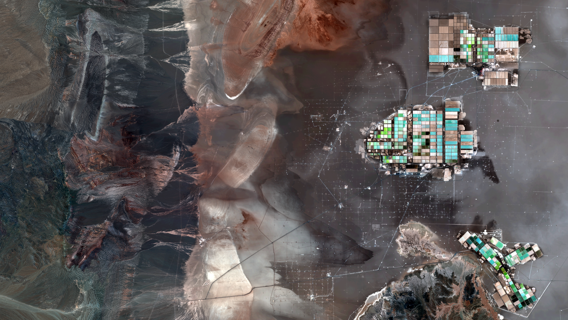
Our satellite image of the month of April shows a section of the Atacama Desert in northern Chile, in which industrial plants for the extraction of lithium can be seen.
The image is based on Sentinel-2 data from the EU Copernicus program. Sentinel-2 data are freely available, multispectral satellite images. After the download, several scenes were merged using free software, corrected for atmospheric conditions and then a color composition was calculated using three different bands.
Structure of the image
The image is based on Sentinel-2 data from the EU Copernicus programme. Sentinel-2 data are freely available, multispectral satellite images. After downloading, several scenes were merged and an atmospheric correction was carried out using free software. A colour composite was calculated using three different spectral bands.
This „natural colour“ band combination is as close to „true colour“ as you can get with a Sentinel-2 image. By using the three bands of visible light that humans see as red, green and blue, the image appears in colours similar to how they appear to the human eye. Vegetation is green, recently harvested fields are very light, soil is yellow and brown and roads and buildings are grey. These three bands provide a spatial resolution of 10 metres.
The Atacama Desert in Chile is one of the driest regions in the world covering approximately 160,000 km² in the north of the country. Due to the extreme aridity, there is hardly any vegetation, but the desert is rich in mineral resources. The image shows a part of the Salar de Atacama, a vast salt flat, located about 55 km south of the town of San Pedro de Atacama.
About the lithium mining
Chile has one of the world’s largest lithium deposits, particularly in the Salar de Atacama, a vast salt flat. It is estimated to contain 27% of the world’s lithium reserves. Lithium is extracted by an evaporation process: saline groundwater is pumped to the surface and left to evaporate in large basins under the sun, creating a highly concentrated brine. Together with Australia and China, Chile is one of the world’s leading lithium producers. The government is seeking to gain greater control over lithium extraction and increase domestic value creation, for example by promoting battery production.
Due to its severe environmental impact, lithium mining is controversial in Chile. The high water consumption threatens fragile ecosystems and the traditional livelihoods of indigenous communities. In the water-scarce Andean highlands, this has led to conflicts with local populations and environmental organisations. Despite these challenges, lithium remains a strategic resource for the energy transition and the global electric vehicle market.
The evaporation basins of industrial plants for the extraction of lithium and other minerals can be clearly recognised in the right half of the picture. The minerals and salts dissolved in the water colour the ponds in bright turquoise and green. To illustrate the dimensions: The middle of the three industrial plants is almost 10 kilometres wide.
A different view of the region
The following animations help understanding the geographical location of the image. They show the location of the satellite image of the month at various scales and an overlay with OSM data. The map visualisations were created using the terrestris OpenStreetMap Premium service.
Contains modified Copernicus Sentinel data (2025)/ESA – created by mundialis
Satellite images for your wall are available at https://art-from-space.de