
Harrat Khaybar – Saudi-Arabien, aufgenommen vom Sentinel-2A Satelliten am 31.01.2024
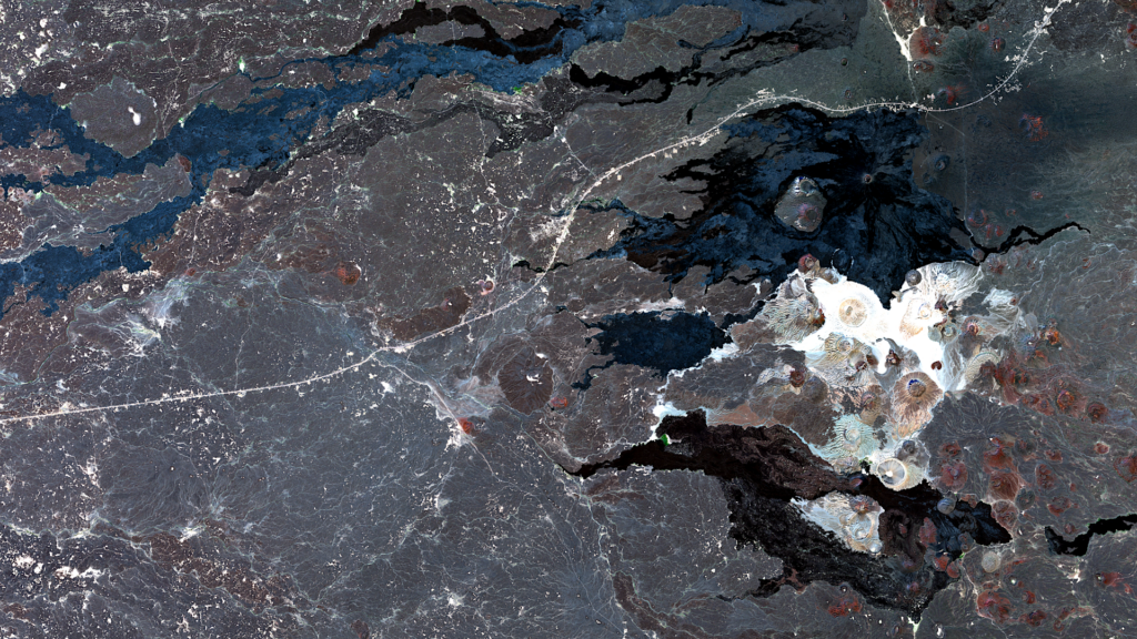
Our satellite image of the month of August shows Harrat Khaybar, a volcanic field in Saudi Arabia.
Structure of the image
Das Bild basiert auf Sentinel-2 Daten des EU Copernicus Programmes. Sentinel-2 Daten sind multispektrale Satellitenaufnahmen, die frei verfügbar sind. Nach dem Download wurde die Szene mit Freier Software atmosphärenkorrigiert und mit drei verschiedenen Bändern eine Farbkomposition berechnet. Hier wurden die drei Kanäle des sichtbaren Lichts (Rot, Grün und Blau) verwendet, sodass das Bild in natürlichen Farben erscheint, die der Wahrnehmung durch das menschliche Auge ähneln. Vegetation ist grün, kürzlich geerntete Felder sind sehr hell, Boden ist gelblich braun und Straßen und Gebäude erscheinen grau. Die räumliche Auflösung des Bildes liegt bei 10 Metern.
About the volcanic field
In addition to vast sandy deserts, the Arabian Peninsula is also home to extensive lava fields, known as harrats. One of the largest of these fields is the 12,000 square kilometer Harrat Khaybar, north of Medina in Saudi Arabia. It was formed by eruptions over the last five million years along a 100-kilometer-long shaft system running north-south. The last known eruption is dated to the 7th century.
The volcanic field can be seen in the right half of the picture and is divided into a northern, dark to black area and a southern, light to white part. The northern part consists of dark basaltic lava flows, while the southern part is characterized by more viscous siliceous, rhyolitic lava.
Jabal Qidr
The most prominent volcano in the northern part of the volcanic region is Jabal Qidr. This is a stratovolcano with a typical cone shape and a diameter of the summit crater of approx. 400 meters. In the picture it can be seen as a small round brownish ring at the top right in the darkest part of the volcanic field. Jabal Qidr is the only stratovolcano in the Harrats in western Saudi Arabia.
Jabal Abyad and Jabal Bayda
The two most famous volcanoes in the southern part of the volcanic field are Jabal Abyad and Jabal Bayda.
Jabal Abyad is the highest volcano in Saudi Arabia at a height of around 2,090 meters above sea level. In contrast to Jabal Qidr, Jabal Abyad is a lava dome with a rock dome as its summit.
Jabal Bayda, on the other hand, is a tuff cone volcano with a much larger summit crater measuring around 1,400 meters in diameter. In the picture, the two volcanoes can be seen in the brightest (almost white) area directly below the black lava field. Jabal Bayda is the large round crater in the left part of the white-colored region, with Jabal Abyad to the east.
A different view of the region
The following illustration will help you to better understand the geographical location of Harrat Khaybar. The animation shows the satellite image of the month and its surroundings at different scales. The map was created using the OpenStreetMap Premium service from our sister company terrestris.
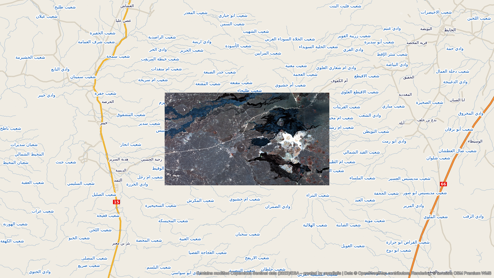
Data © OpenStreetMap contributors, Rendering: © terrestris OSM Premium WMS
Contains modified Copernicus Sentinel data (2024)/ESA – created by mundialis
Satellite images for the wall are available at https://art-from-space.de