
Mahalangur Himal– Nepal/China – recorded by the Sentinel-2B satellite on March 17, 2024
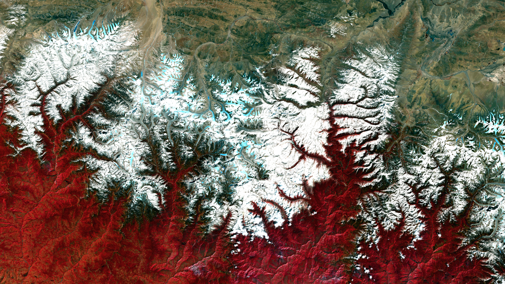
Our satellite image of the month December shows the Mahalangur Himal massif, which is part of the Himalayas and home to the world’s highest mountains, including Mount Everest, also known in the region as Sagarmatha or Qomolangma.
Structure of the image
The image is based on Sentinel-2 data from the EU Copernicus programme. Sentinel-2 data consists of freely available multispectral satellite images. After downloading, two scenes were merged, and atmospherically corrected using open-source software. Subsequently, a color composite was computed using three different bands. The chosen color infrared composite is particularly well suited for visualising vegetation. Vegetation appears in various shades of red, older vegetation in green, soil in shades of brown and green, urban areas in blue-grey, clouds, snow and ice in light turquoise or white.
About the Mahalangur Himal massif
The pictured mountain range lies on the border between Nepal and the Tibet Autonomous Region. The Tibetan highlands extend to the north, while the topography slopes down to the Nepalese Plateau to the south. With Mount Everest, Lhotse, Makalu and Cho Oyu, the massif is home to four mountains that reach a height of over 8,000 metres. With an altitude of 8,848 metres, Mount Everest is the highest mountain in the world and attracts thousands of tourists and mountaineers every year, making it a key economic factor for Nepal. The demand for guided mountain and trekking tours has grown steadily in recent years, benefiting the people in the region economically. However, the increase in tourism also brings with it environmental challenges, such as pollution from waste and the impact on fragile mountain ecosystems.
On the satellite image, three regions can be clearly distinguished by colour. Due to the chosen false colour representation, the barren Tibetan highlands in the upper part of the image, which have hardly any vegetation due to the climate, appear in shades of brown and ochre. In the centre of the image is the mountain range, whose glaciated and snow-covered peaks are shown in white. The glaciers are clearly visible in a light turquoise. The southern side of the Himalayas is significantly wetter than the northern side and therefore has more vegetation, which is why the area in the lower part of the image is coloured red.
International Day of Mountains
Our satellite image of the world’s highest mountain region is intended to draw attention to the International Mountain Day on 11 December, which was established by the United Nations in 2002. The day aims to highlight the special importance of mountain regions for life on Earth and their sustainable development.
A different view of the region
The following visualisations help to better understand the geographical location of the
Mahalangur Himal massif. The animations show the satellite image of the month and its surroundings at different scales and an overlay with OSM data, both clearly showing the borderline in the middle of the mountain range. The maps were created using the OpenStreetMap Premium service from our sister company terrestris.
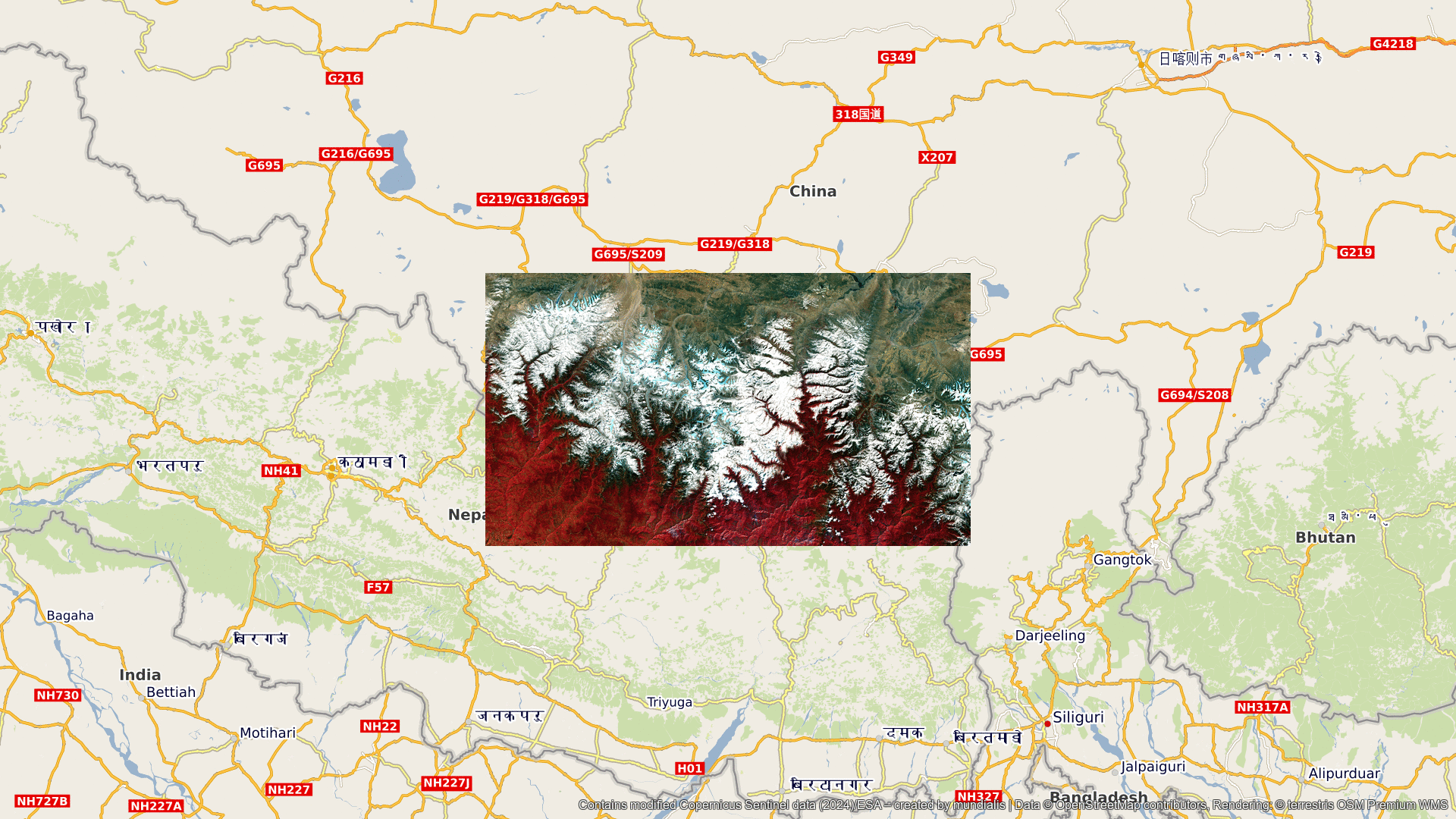

Contains modified Copernicus Sentinel data (2024)/ESA – created by mundialis
Satellite images for the wall are available at https://art-from-space.de