
Mangoky Delta – Madagascar, captured by the Sentinel-2B satellite on January 10, 2025
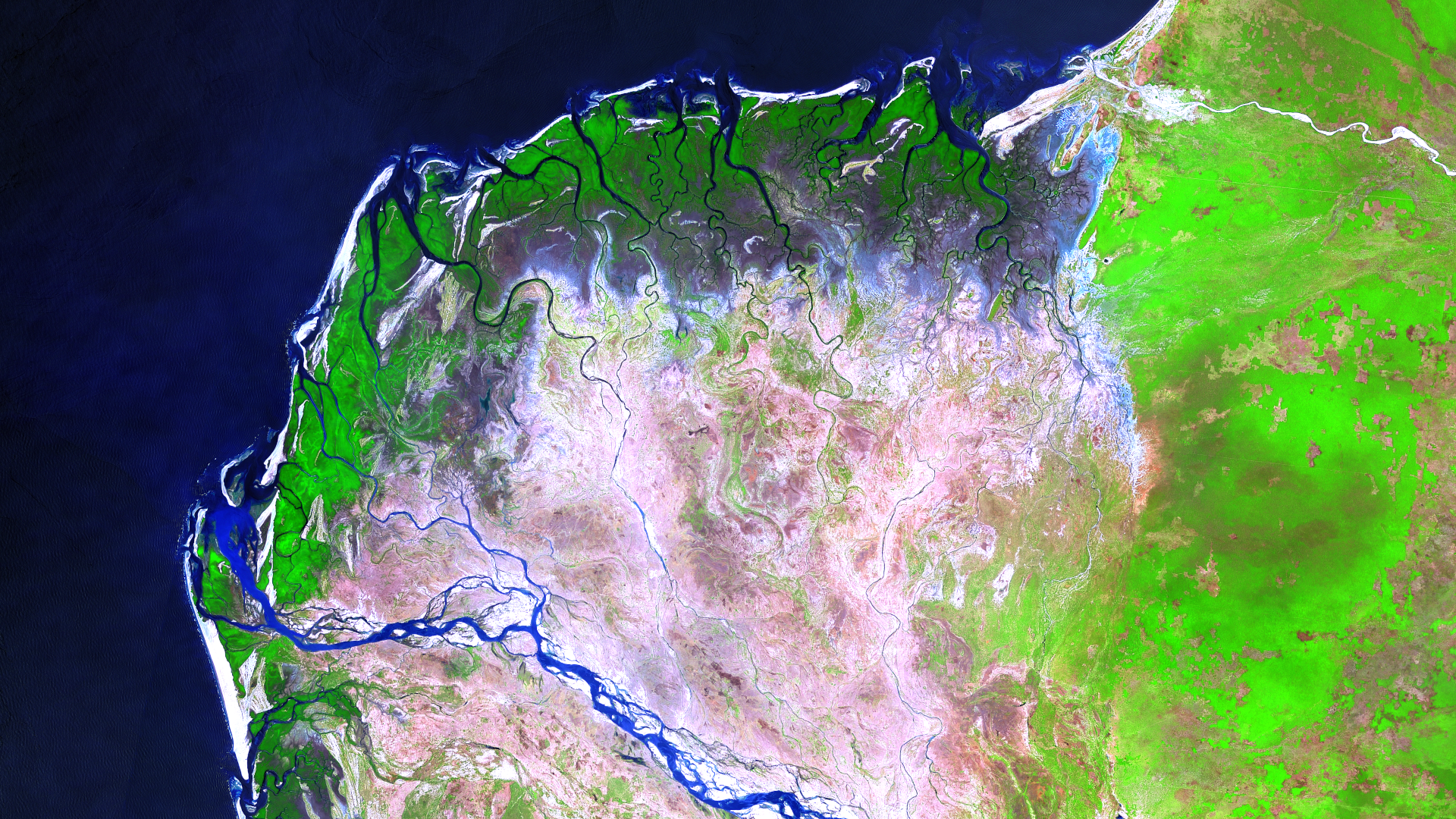
Our satellite image of the month for February features the delta of the Mangoky River on the west coast of Madagascar.
Image Composition
The image is based on Sentinel-2 data from the EU Copernicus Program. Sentinel-2 data consists of freely available multispectral satellite images. After downloading, the scene was stitched together using open-source software, corrected for atmospheric distortions, and then a color composition was generated from three different spectral bands. For the chosen composition, the following channels were used Band 11 (shortwave infrared), Band 8A (visible and near-infrared) and Band 4 (visible red). This false-color composition enables vegetation analysis, among other applications. Healthy vegetation appears in vibrant green tones and can be easily distinguished from soil, which ranges in color from pink (e.g., harvested fields) to bright pink (e.g., deforested rainforest). Clouds appear white, water is depicted in dark blue to black shades, and urban areas are shown in light gray to pale pink.
About the Delta
The Mangoky Delta on Madagascar’s west coast is a dynamic and ecologically significant region where the Mangoky River flows into the Mozambique Channel. This vast delta features a complex network of branching channels and is home to diverse ecosystems, including mangrove forests and wetlands.
The mangrove forests of the delta are particularly noteworthy, as they provide essential habitats for various species and act as a natural buffer against coastal erosion. However, in recent decades, the extent of the mangrove forests has declined, mainly due to human activities such as deforestation for agriculture and firewood collection.
There are ongoing efforts to protect and restore the delta’s ecosystems, recognizing their importance for biodiversity, local livelihoods, and coastal protection. For instance, the northern part of the delta has been designated as a protected area to preserve sections of the mangrove forest.
The Mangoky River Delta experiences seasonal fluctuations, with floods and droughts shaping the landscape. During the dry season, some of the delta’s channels may run dry, while during the rainy season, floods can significantly alter the region’s appearance and ecology.
Locating the Delta in the Satellite Image
In the satellite image, the water of the sea and rivers appears blue, making the intricate river system clearly visible. Healthy vegetation is shown in green: the coastal mangrove forests can be seen, while in the eastern part of the image, a larger vegetated area inland is noticeable. In contrast, the interior of the delta is depicted in light brown to pink hues, indicating eroded soil or deforested land.
A Different Perspective on the Region
To better understand the geographic location of the Mangoky Delta, the following visualizations are helpful. The animations display the satellite image of the month and its surroundings at different scales, along with an overlay of OSM data. The map representations were created using the OpenStreetMap Premium service of our sister company, terrestris.
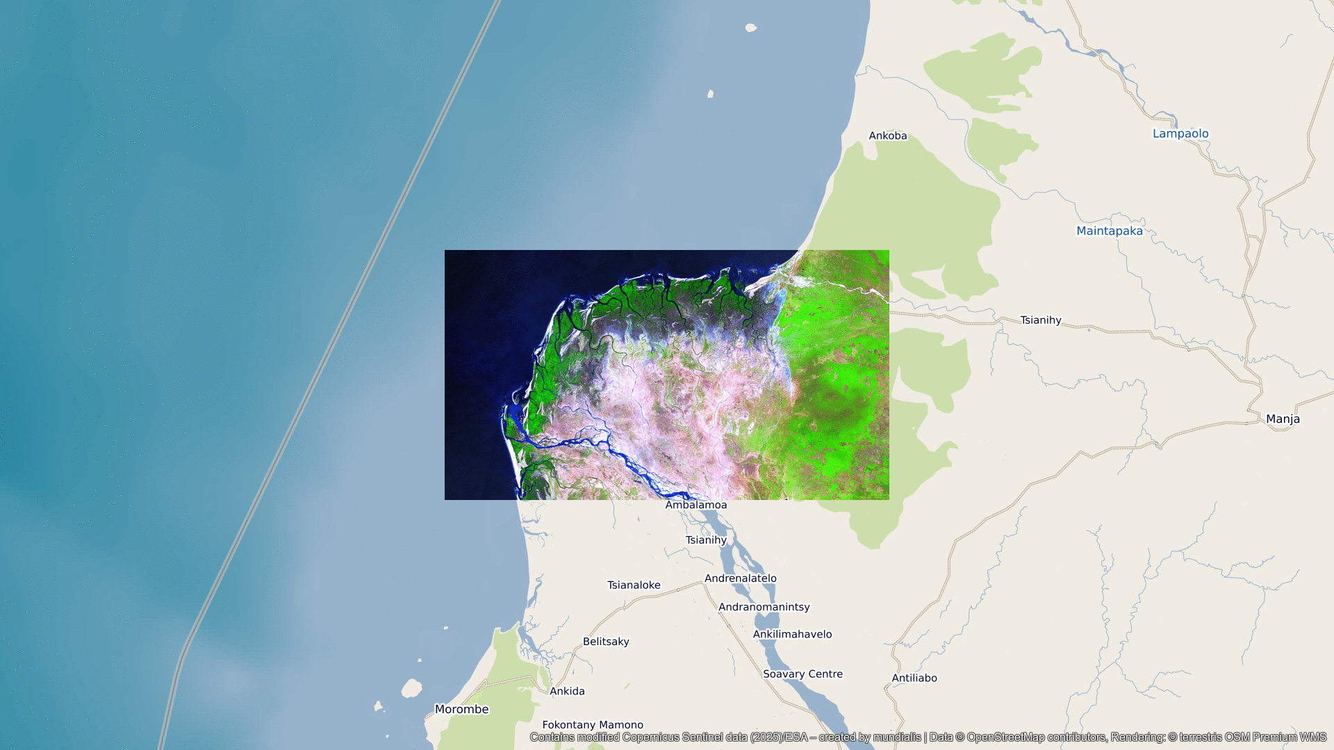
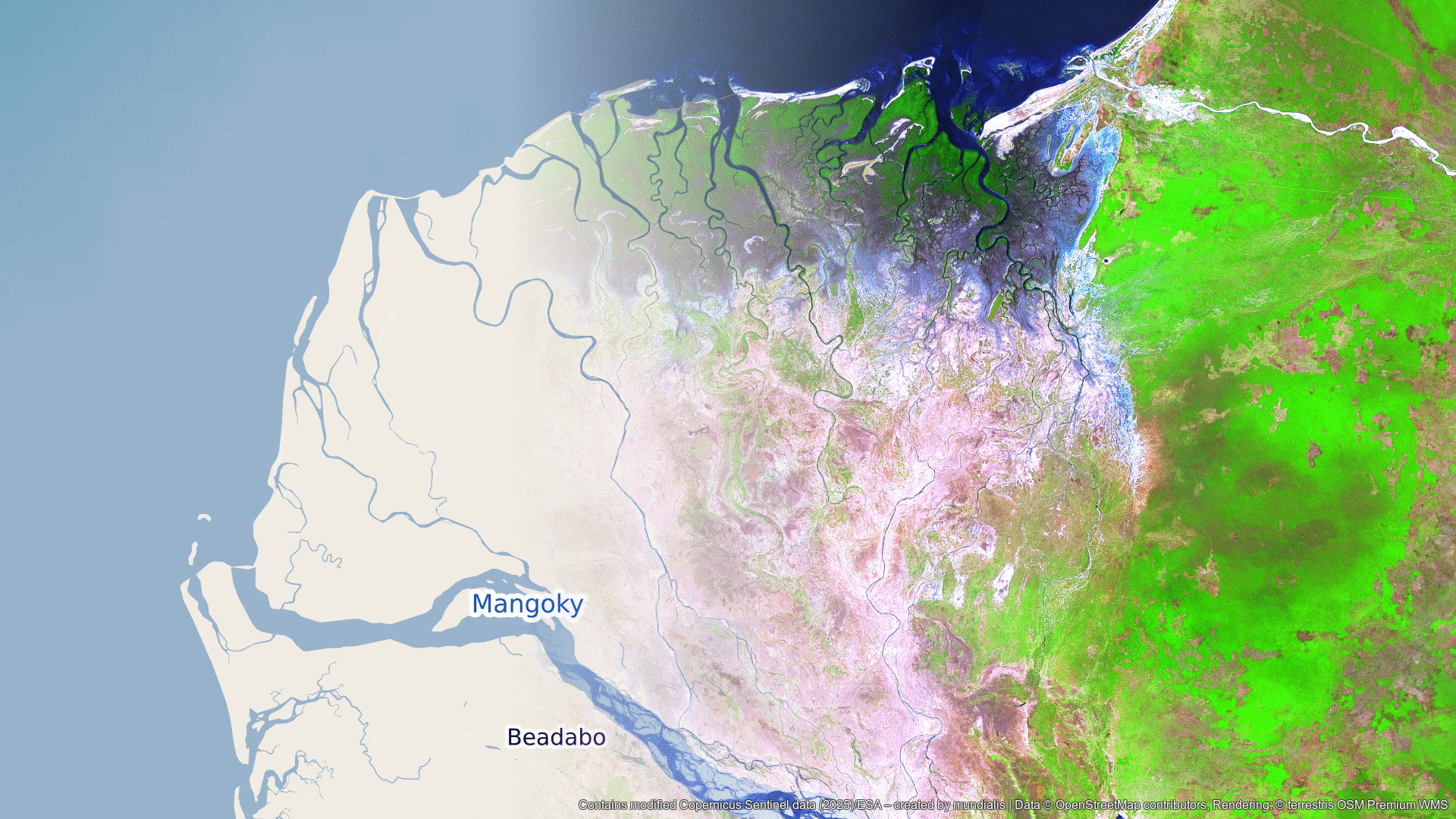
Contains modified Copernicus Sentinel data (2025)/ESA – created by mundialis
Satellite images for your wall are available at: https://art-from-space.de