
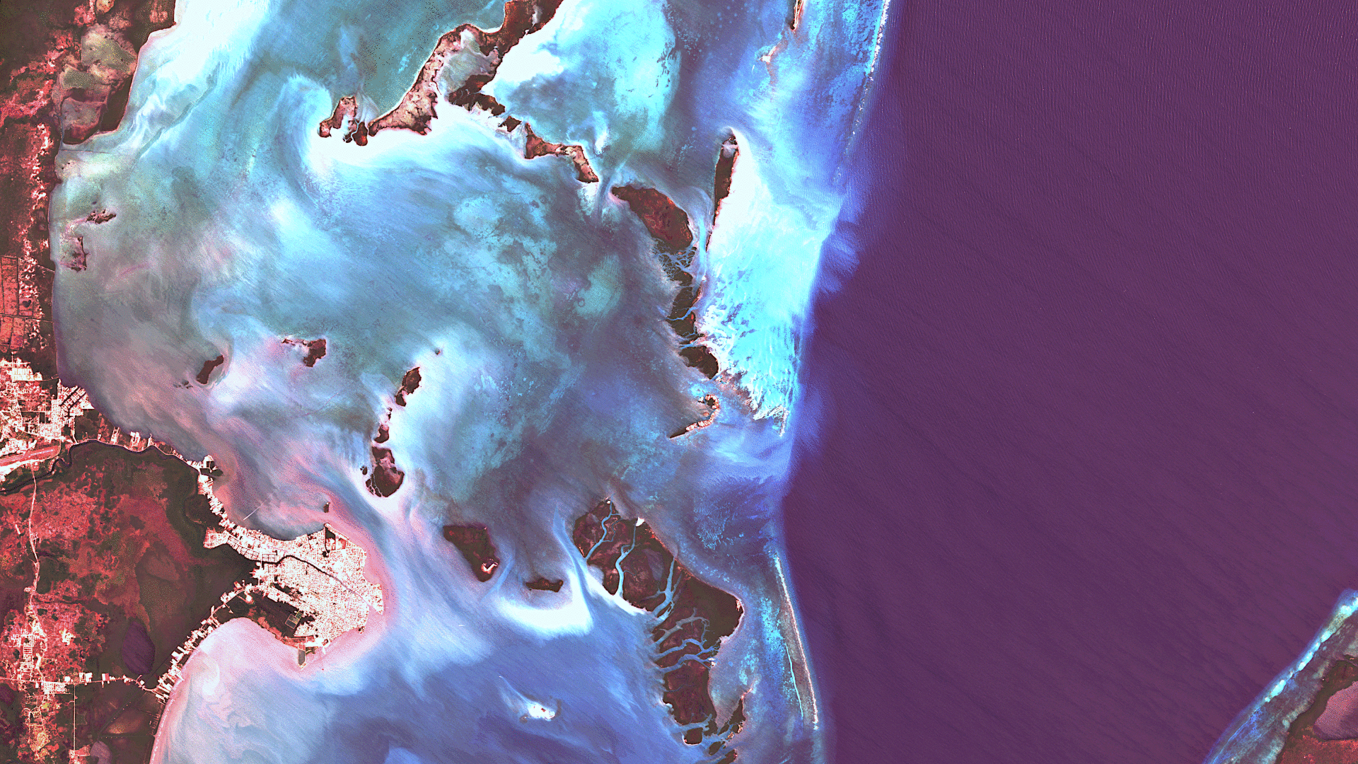
Belize City – Belize, recorded by the Sentinel-2B satellite on April 10, 2024
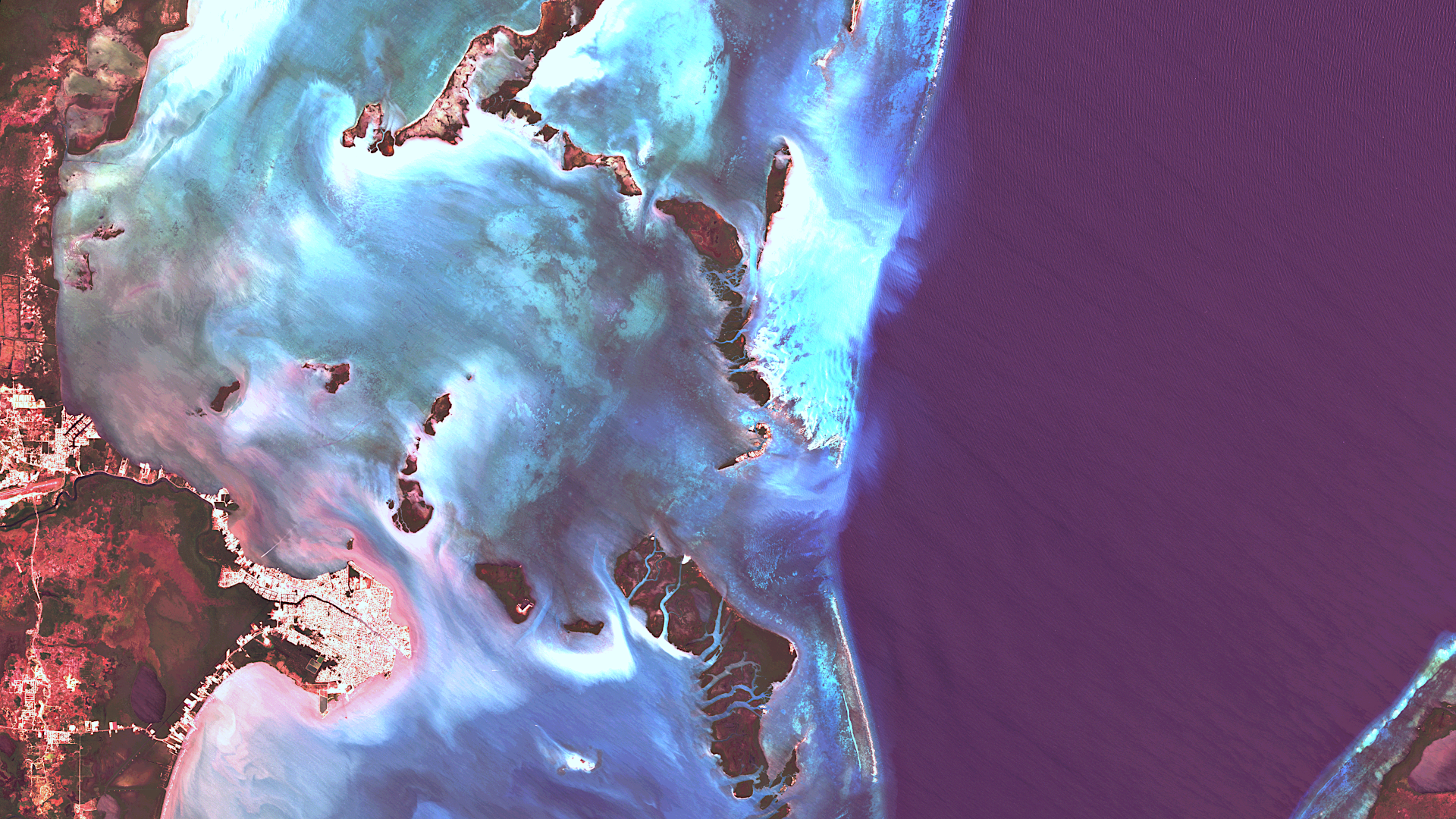
Our satellite image of the month July shows Belize City, the largest city in the Central American state of Belize, and its surroundings on the Caribbean coast.
The image is based on Sentinel-2 data from the EU Copernicus programme. Sentinel-2 data consists of freely available multispectral satellite images. After downloading, the scene was atmospherically corrected using free software, and subsequently, a color composition was calculated using three different bands.
Structure of the image
The three bands of visible light that we see as red, green and blue have been used for this „natural colours“ combination, so that the image appears in colours similar to what we see with our eyes. Vegetation is green, recently cleared fields are very light, soil is yellow and brown and roads and buildings are grey. Clouds and snow appear white and are difficult to distinguish. Sometimes this band combination appears hazy because these wavelengths cannot penetrate the atmosphere very well. These three bands provide a spatial resolution of 10 metres.
About Belize
Belize is a small country in Central America, bordering Mexico, Guatemala and the Caribbean Sea. It is the only country in the region whose official language is English, a legacy of its British colonial history. Belize gained independence from Great Britain in 1981. The capital of Belize is Belmopan, but the country’s largest city and economic centre is Belize City. The city was founded in the 17th century by British labourers as a logging settlement and now has a population of around 62,000. It can be seen in bright white at the bottom left of the picture.
The barrier reef
Belize City is located on the coast and is the country’s most important harbour. The offshore reef is the second largest barrier reef in the world after Australia’s Great Barrier Reef. It runs parallel to the entire coast of the country and protects numerous smaller reefs, sandbanks and over 1,000 islands, known as cayes. Both the coast and the islands are covered in mangrove forests, which protect the coast from erosion.
The image clearly shows that the barrier reef separates the open sea on the right from the lagoon at the coast. While the deeper open sea appears in dark blue tones, the shallow waters of the lagoon are light blue and turquoise. The overgrown areas of the islands and the mainland are dark green in colour. Uncovered ground appears red, which is not unusual in tropical areas. In the picture, the red sediments can even be seen in the sea near the coast.
A different view of the region
The following illustrations help to place the region geographically. They have been created using the OpenStreetMap Premium service from our sister company terrestris. As usual, the image zooming out shows the location of the image in the country or countries in the neighbourhood. The second animation is a nice overlay of the two elements of image and map.
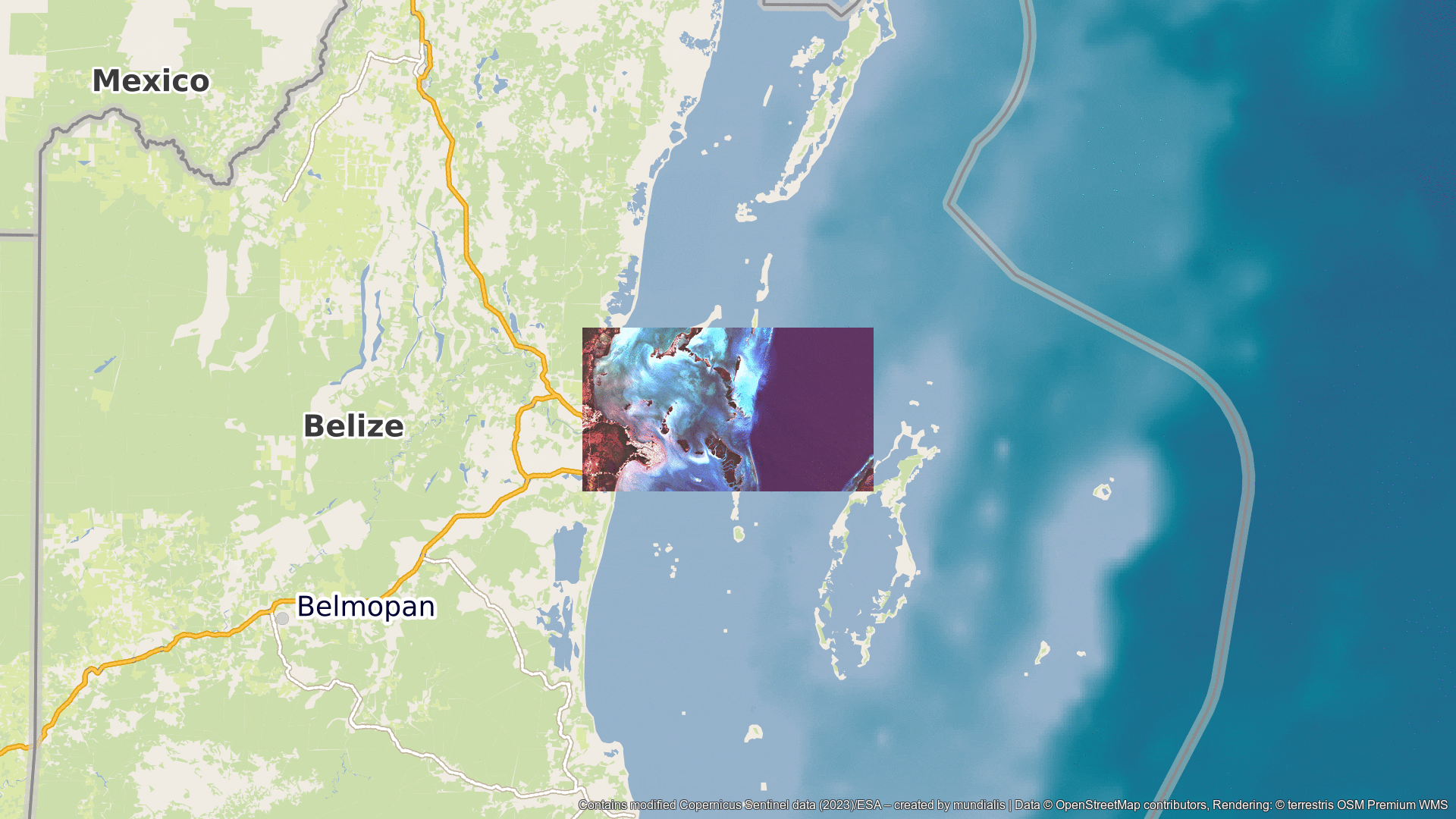
Data © OpenStreetMap contributors, Rendering: © terrestris OSM Premium WMS
Contains modified Copernicus Sentinel data (2024)/ESA – created by mundialis
Satellite images for the wall are available at https://art-from-space.de