
Münster – Germany – recorded by the Sentinel-2A satellite on September 20, 2024

Our satellite image of the month March shows the city of Münster and its surroundings in the north of the German state of North Rhine-Westphalia.
Structure of the image
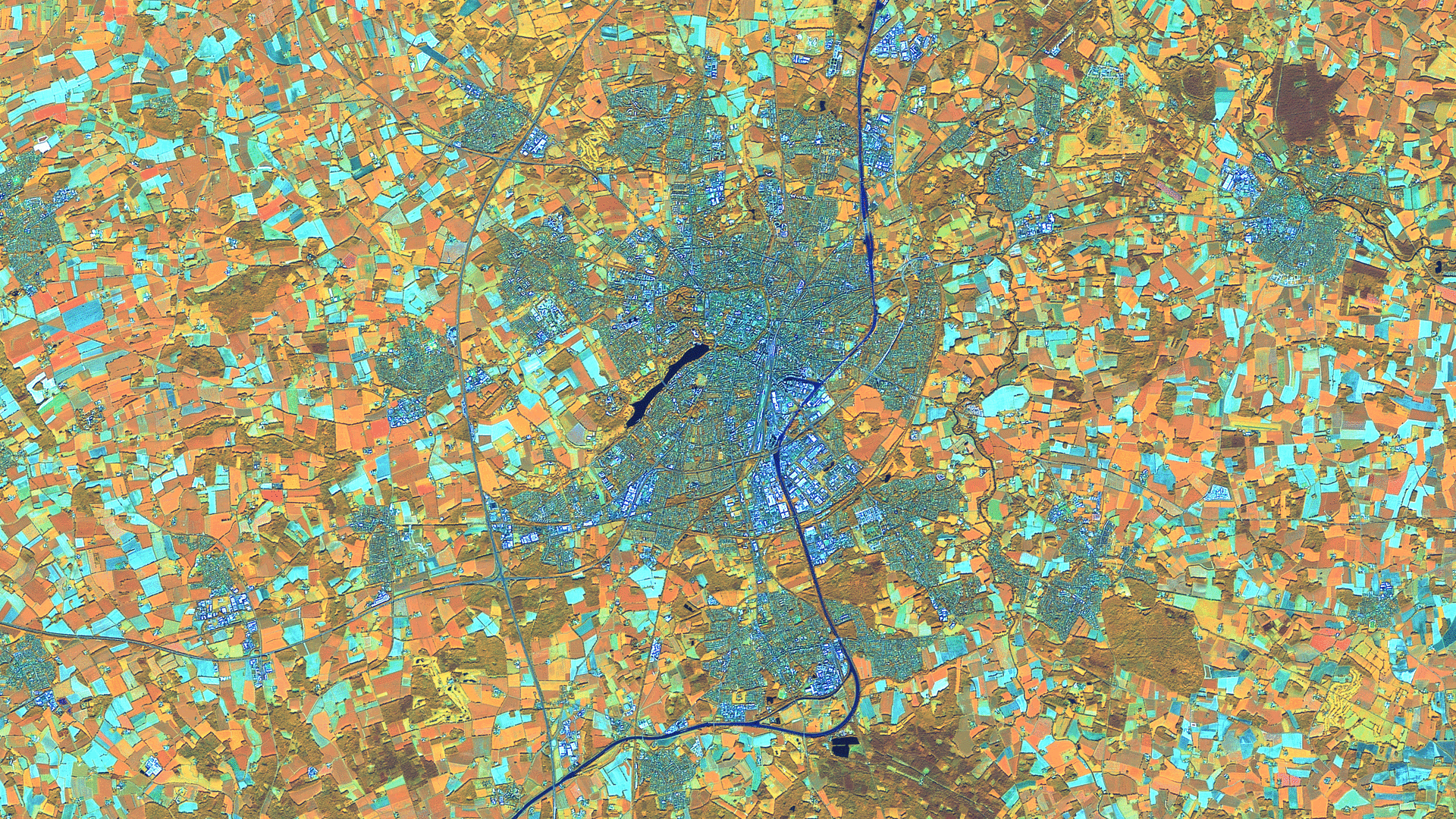
This image shows a color composite created from different bands based on Sentinel-2 data of the EU Copernicus Programme. Sentinel-2 data are freely available, multispectral satellite images. After the download, several scenes were merged and an atmospheric correction was carried out with free software. A color composite was calculated using three different spectral bands.
This false color composite maes it easy to distinguish between land and water. For this composite, the bands 8A (visible and near infrared), 11 (short-wave infrared) and 4 (visible red) were used. The final images has a spatial resolution of 20 meters. Healthy vegetation appears in orange and older vegetation in green. Soil and clouds also appear in shades of green. Water is shown in dark blue blue and urban areas are depicted in blue-grey.
About the city
Münster is an independent city in North Rhine-Westphalia with around 307,000 inhabitants and is considered one of the most bicycle-friendly cities in Germany. It was founded in the 9th century and developed into an important religious and cultural centre. The city is home to the University of Münster, which is one of the largest universities in Germany with around 65,000 students. The university headquarters are located in the building of the former prince-bishop’s palace, now Münster Palace.
Münster was badly destroyed in the Second World War, but many historic buildings, especially on Prinzipalmarkt, were rebuilt true to the original. Today, this central square with its gabled houses characterises the cityscape. The Aasee, an artificial lake in the city centre, is both a popular local recreation area and a fresh air corridor for the city. With its mixture of history, culture and modern urbanity, Münster is considered one of the most attractive cities in Germany.
On the satellite image, the built-up urban area of Münster, which is in shades of grey to blue, can be distinguished from the surrounding agricultural area. The fields are coloured orange or, if already harvested and with open ground, turquoise. Water surfaces can be recognised in dark blue to black. The Dortmund-Ems Canal crosses the urban area in a north-south direction. Lake Aasee can be seen to the south-west of the city centre. The prince-bishop’s palace with the university headquarters is located slightly north of Lake Aa, bordering the city centre to the west. On closer inspection, the star-shaped moat can be recognised.
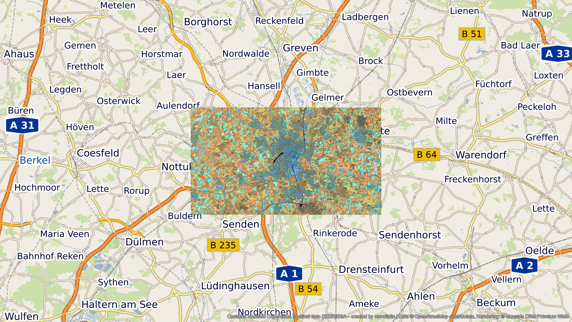
A different view of the region
To facilitate geographical placement, please refer to the following animation, which shows the satellite image of the month at various scales of the terrestris OpenStreetMap service.
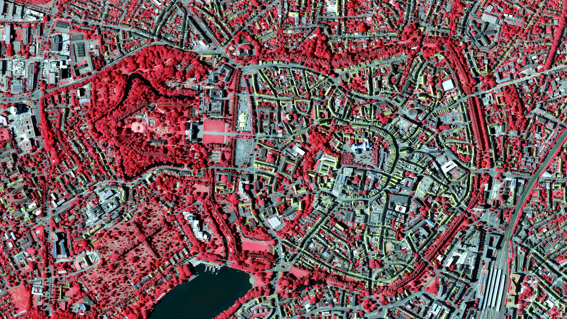
A detailed view of the castle
In addition to the satellite image, this month we are also showing a digital orthophoto (DOP) of Münster. DOPs are created from aerial images and a processing that produces a distortion-free and true-to-scale image. DOPs for North Rhine-Westphalia are freely available via Geobasis NRW and contain four spectral bands (red, green, blue and near-infrared). In the image shown here, the near-infrared, red and blue bands have been combined to create a false colour representation that makes the vegetation appear red. Thanks to the high resolution of 10 cm, Münster Castle is easily recognisable. The almost star-shaped moat surrounding the botanical garden is particularly striking.
FOSSGIS 2025
From 26 to 29 March 2025, Münster Castle will be the venue for this year’s FOSSGIS conference. The conference focuses on free and open source software for geoinformation systems (FOSSGIS), open data and OpenStreetMap (OSM). Developers, users and researchers will come together to present and discuss the latest developments and projects in these areas.
At FOSSGIS 2025, mundialis and terrestris will once again be representing the topics of Earth Observation (EO) and GIS. Which image could symbolise this better than the cross-fade between remote sensing data from the satellite image and the corresponding section of a rendering of, primarily, data from the OpenStreetMap project in the corresponding image section? 🤝
Here you can view the contributions and workshops of mundialis and terrestris as well as the complete programme of FOSSGIS 2025.
Contains modified Copernicus Sentinel data (2024)/ESA – created by mundialis
Satellite images for your wall are available at https://art-from-space.de