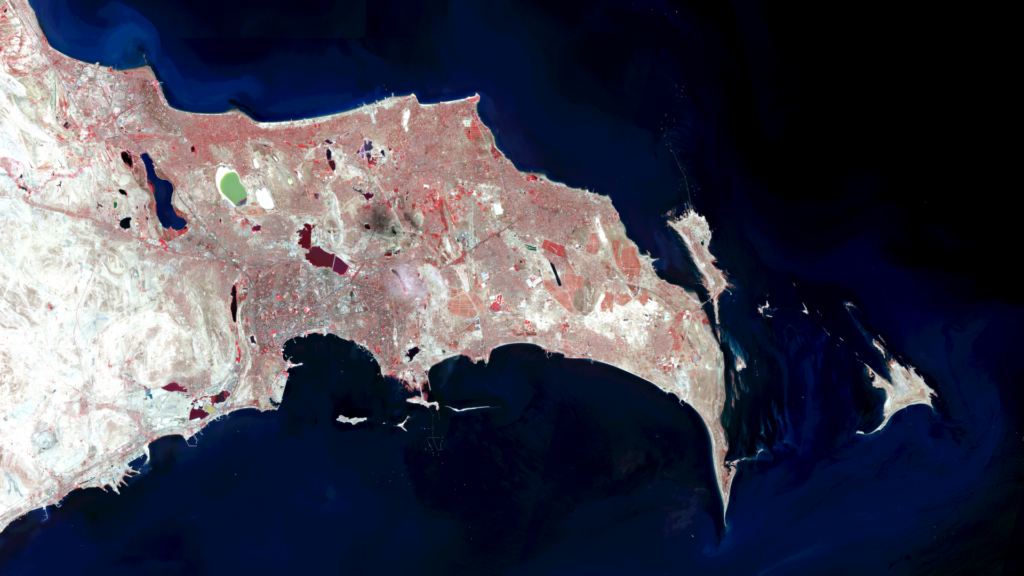
Baku – Azerbaijan, recorded by the Sentinel-2A satellite on September 01, 2024

Our satellite image of the month November shows the city of Baku in Azerbaijan and its surroundings.
Structure of the image
The image is based on Sentinel-2 data from the EU’s Copernicus programme. Sentinel-2 data are freely available multispectral satellite images. After the download, several scenes were merged and atmospherically corrected using free software. Then a color composition was calculated using three different bands.
The chosen colour infrared (vegetation) composite is based on the bands red, green and near infrared and is particularly well suited for visualising vegetation. Vegetation appears in various shades of red, older vegetation in green, and soil in shades of brown and green. Urban areas are shown in blue-grey while clouds, snow and ice are light turquoise or white.
In the image, Baku is located in the middle of the southern shore of the Abşeron peninsula and can be seen in predominantly dark grey. Parks and other green areas are grey. Other urban areas are located to the east and north of Baku. Agricultural areas are coloured in red and are mainly located in the eastern part of the peninsula. Several lakes are shown in dark colours, while the Masazir and Mirzaladi salt lakes are turquoise and white respectively. The chosen false-colour composite illustrates that there is little vegetation in the sparsely populated hills west of Baku.
About the city
Baku is the capital of Azerbaijan and, with two million inhabitants, it is both the most populous and largest city in the country and the entire Caucasus. The city is located on the western shore of the Caspian Sea on the Abşeron peninsula, about 28 metres below sea level. This makes it the lowest capital city in the world. Baku has a semi-arid climate. The summers are hot and dry, and the winters are mild but windy.
The city combines a rich history dating back to ancient times with modern architecture. Its location on several important trade routes favoured the city’s development in the past. The historic centre of Baku, which has been a UNESCO World Heritage Site since 2000, is home to important historical buildings such as the Shirvanshah Palace. At the same time, futuristic buildings such as the Flame Towers and the Heydar Aliyev Centre characterise the modern cityscape.
Today, Baku is an important centre of the oil industry, which has determined the city’s economic development since the 19th century. The region is an oil-producing area, several pipelines run through the city and Baku’s harbour is an major oil transshipment point.
The city’s cultural life is diverse, with numerous international events and festivals. The city is also the venue for the Formula 1 Azerbaijan Grand Prix.
COP 29
Baku is the venue for the 29th UN Climate Change Conference, also known as COP 29 (Conference of the Parties 29), which will take place from 11 to 24 November this year. The main aim of the annual conference is to coordinate global measures to combat climate change and to commit countries to working together to reduce greenhouse gas emissions and adapt to the consequences of climate change.
A different view of the region
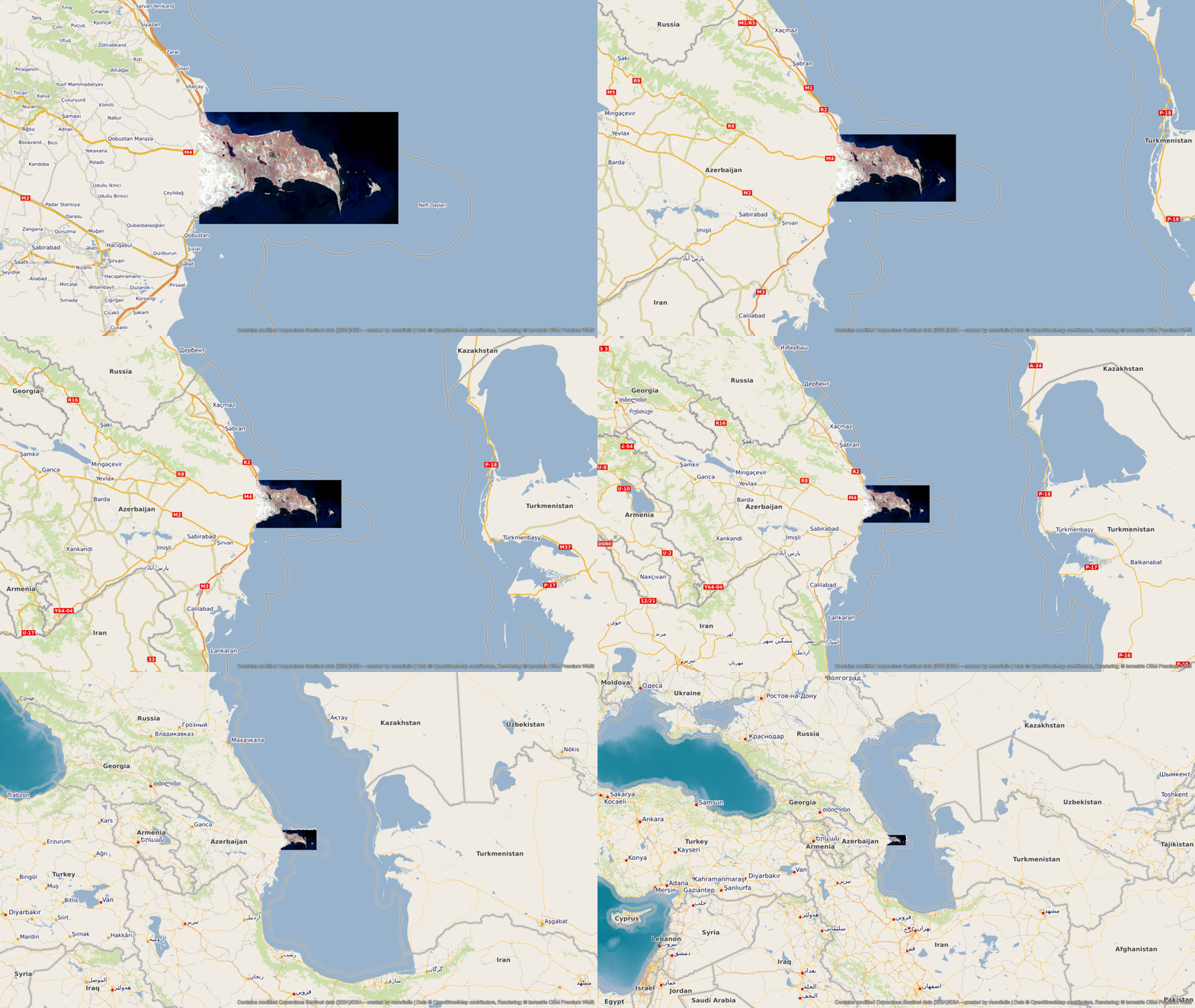
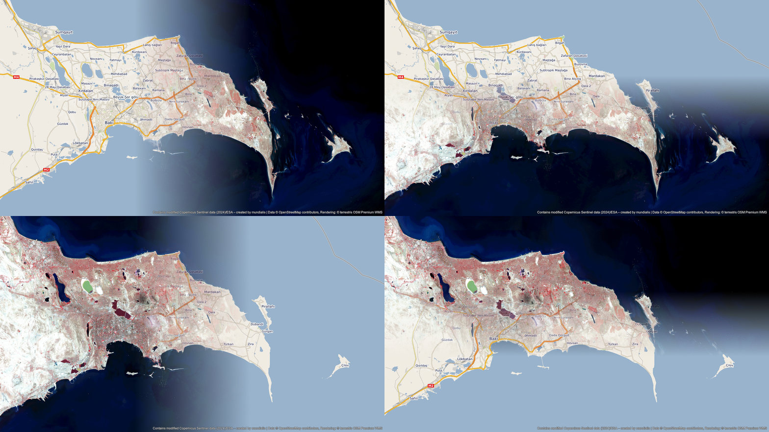
The following visualisations will help you to better understand the geographical location of Baku. The animations show the satellite image of the month and its surroundings at different scales and an overlay with OSM data. The maps were created using the OpenStreetMap Premium service from our sister company terrestris.


Contains modified Copernicus Sentinel data (2024)/ESA – created by mundialis
Satellite images for the wall are available at https://art-from-space.de
