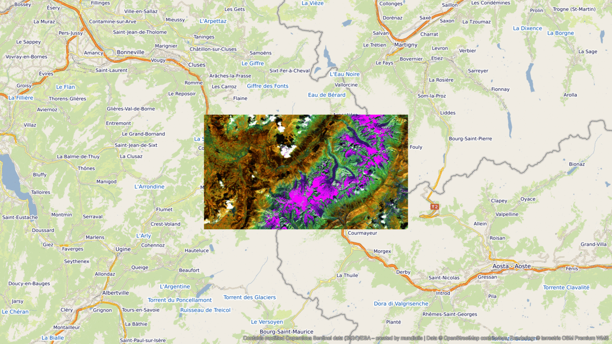
Mont Blanc – France & Italy, recorded by the Sentinel-2A satellite on August 31, 2024
Our satellite image of the month for October shows the Mont Blanc massif in the French and Italian Alps.
The image is based on Sentinel-2 data from the EU Copernicus program. Sentinel-2 data are freely available, multispectral satellite images. After the download, the scene was atmosphere-corrected using free software and then a color composition was calculated using three different bands.
Structure of the image
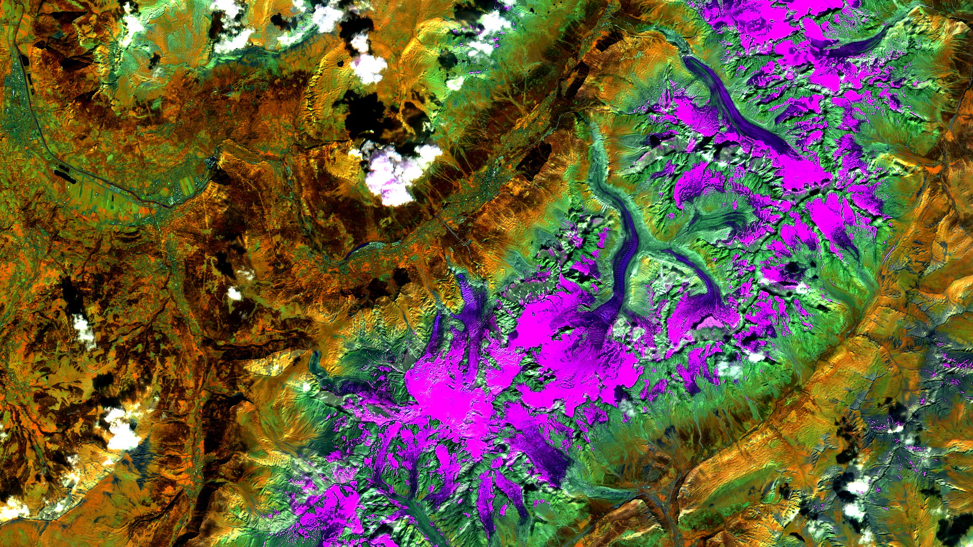
For this land/water composition, channels 8A (visible and near infrared), 11 (short-wave infrared) and 4 (visible red) were used. Healthy vegetation appears in orange and older vegetation in green. The ground and clouds also appear in different shades of green. Water is painted in shades of blue while ice appears in dynamic magenta. As the bands 8A and 11 are only available in a 20 m resolution, they were sharpened using pan image sharpening. For this purpose, a pseudo-panchromatic band was used, which was generated from the bands that are available in a 10 m resolution (bands 2, 3, 4 and 8).
About the Mont Blanc Massive
At 4,805 meters, Mont Blanc is the highest mountain in the Alps and Western Europe. It lies on the border between France (in the top left-hand corner of the picture) and Italy (in the bottom right-hand corner of the picture) and is part of the so-called Mont Blanc group. However, the exact borderline is disputed: France claims the summit region for itself, while Italy believes the border runs across the summit.
There are several important glaciers around Mont Blanc, such as the Mer de Glace, the largest glacier in France with a length of around 12 kilometers, and the Glacier des Bossons, which also flows down into the valley on the French side of Mont Blanc to an altitude of 1,400 m above sea level. These glaciers characterize the landscape of the region and offer spectacular views. However, they have been severely affected by melting due to climate change, especially in recent years. The Mer de Glace has already retreated by 2 kilometers in the last 150 years and is currently losing 4 to 6 meters in height every year in its final section.
At the foot of Mont Blanc in the Arve valley lies the town of Chamonix (in the middle of the picture), which is considered the center of alpinism. The town offers numerous tourist attractions, including the famous cable car to the Aiguille du Midi, which takes visitors up to an altitude of 3,842 meters in just under 20 minutes.
Location on the satellite image
On the satellite image, the glaciers of the Mont Blanc massif can be seen in shades of magenta to dark blue. While the light magenta areas represent the higher altitudes where the glacier surface is covered in snow, the lower altitudes are colored in dark purple to blue tones. High altitudes, where vegetation is sparse and rocks and scree dominate the surface, appear in shades of green. Vegetation areas, i.e. mainly the valley areas, are shown in brown and orange tones. Built-up areas, such as Chamonix, are colored in green to blue tones.
The Mer de Glace is located slightly to the right of the center of the image and is recognizable as the longest glacier tongue flowing north into the valley. To the west of it is the Glacier des Bossons, which is closest to the town of Chamonix visible in the valley. The summit of Mont Blanc lies in the glaciated area from which the tongue of the Glacier des Bossons flows down.
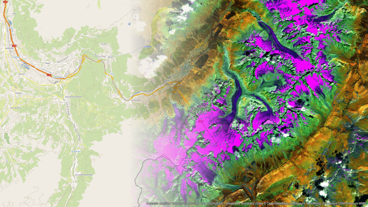
A different view of the region
The following illustrations will help you to better understand the geographical location of Mont Blanc Massive. The animations show the satellite image of the month and its surroundings at various scales. The maps were created using the OpenStreetMap Premium service from terrestris.