
Northern Aral Sea – Kazakhstan, recorded by the Sentinel-2A satellite on July 04, 2024
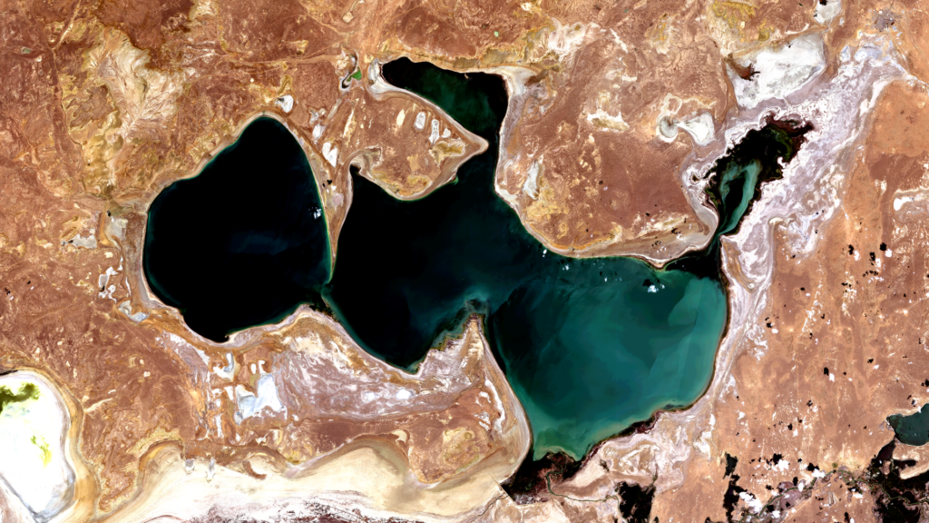
The satellite image of the month of September shows the northern Aral Sea in Kazakhstan, a remnant of the Aral Sea that has disappeared due to silting up and drying out.
The image is based on Sentinel-2 data from the EU Copernicus program. Sentinel-2 data are freely available, multispectral satellite images. After the download, the scene was atmosphere-corrected using free software and then a color composition was calculated using three different bands.
Structure of the image
This ‘natural colour’ combination looks as similar to ‘real colour’ as is possible with Sentinel 2 data. It uses the three bands of visible light, red, green and blue, so that the image appears in colours similar to what we perceive with the human eye. Vegetation is green, recently harvested fields are very bright, soil is yellowish brown and roads and buildings appear gray. Clouds and snow appear white and are difficult to distinguish. This combination of channels enables a spatial resolution of 10 metres.
About the northern Aral Sea
The northern Aral Sea, also known as the Small Aral Sea, is the northern part of the originally larger Aral Sea, which is located in Central Asia between Kazakhstan and Uzbekistan. Due to intensive irrigation measures in the 20th century, in particular to support cotton cultivation, the Aral Sea underwent a drastic shrinkage. This led to its separation into two main basins: the North Aral Sea and the South Aral Sea.
The lake is located entirely on Kazakh territory and has been recovering since the early 2000s thanks to the construction of the Kokaral Dam, which has led to a reduction in evaporation and a significant recovery of the water level in the northern basin. In consequence, some fish species have returned, revitalising local fisheries. Despite these positive developments, the northern Aral Sea remains only a fraction of its original size.
The South Aral Sea, on the other hand, continues to shrink, making the region a significant symbol of environmental degradation and mismanagement. In 1950, the surface area of the entire Aral Sea was 65,607 square kilometres, whereas in 2015 it had shrunk to 8,303 square kilometres.
As the lake has dried out, a salt and dust desert has formed on the areas that were once under water. The very salty areas in the picture are coloured white, while bare ground, sand and rock are coloured in various shades of brown. The Kokaral dam can be seen in the centre at the bottom of the picture. The main tributary of the lake, the Syrdarja, flows into the lake to the east of the dam. The deeper areas of the lake are shown in black, while the shallower areas, especially in the eastern part of the lake, appear in turquoise.
A different view of the region
The following visualisation helps to better understand the geographical location of the northern Aral Sea. The animation shows the satellite image of the month and its surroundings at different scales. The map was created using the OpenStreetMap Premium service from our sister company terrestris.
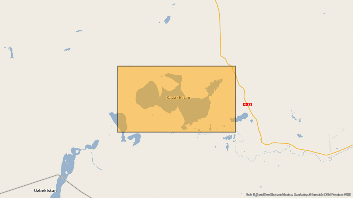
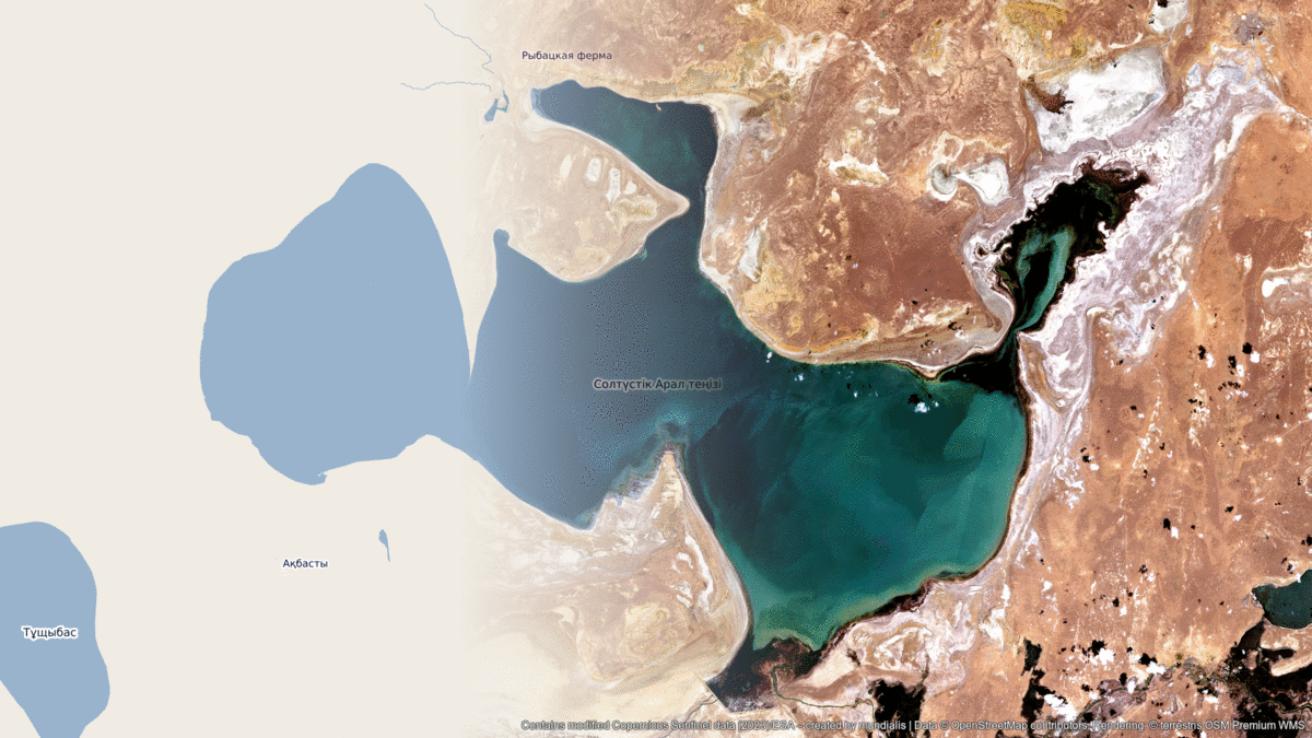
Contains modified Copernicus Sentinel data (2024)/ESA – created by mundialis
Satellite images for the wall are available at https://art-from-space.de