
What Satellites Can Tell Us About Our Past – Join Our Webinar
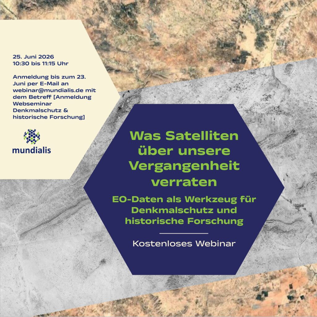
We warmly invite you to our webinar, “What Satellites Reveal About Our Past: Earth Observation Data as a Tool for Heritage Conservation and Historical Research,” taking place on 25 June 2026 from 10:30 to 11:15 a.m. What it’s about: Cultural heritage sites are facing growing challenges from urbanization, land-use change, and increasing environmental risks such […]
Analysis Ready Data – Webinar-recording now online
Sentinel-1 and Sentinel-2 data offer enormous potential for environmental monitoring, land cover analysis, and municipal applications. However, getting started can often seem complex—especially due to preprocessing steps and the variety of data products. In this webinar, we show how Analysis Ready Data (ARD) significantly simplifies access. We provide a practical overview of available ARD offerings […]
High-resolution surface classification with AI and open geodata – Webinar recording
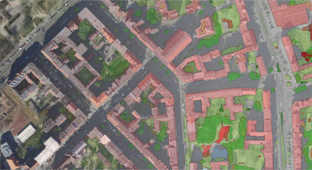
In the second part of our impervious surface series, we demonstrate how freely available true orthophotos can be transformed into a detailed, high-resolution land cover classification using modern AI architectures. Building on our flexible AI framework, we provide an overview of current AI developments and demonstrate their added value in the semantic segmentation of urban […]
High-Resolution Surface Classification with AI and Open Geospatial Data – Webinar Invitatio
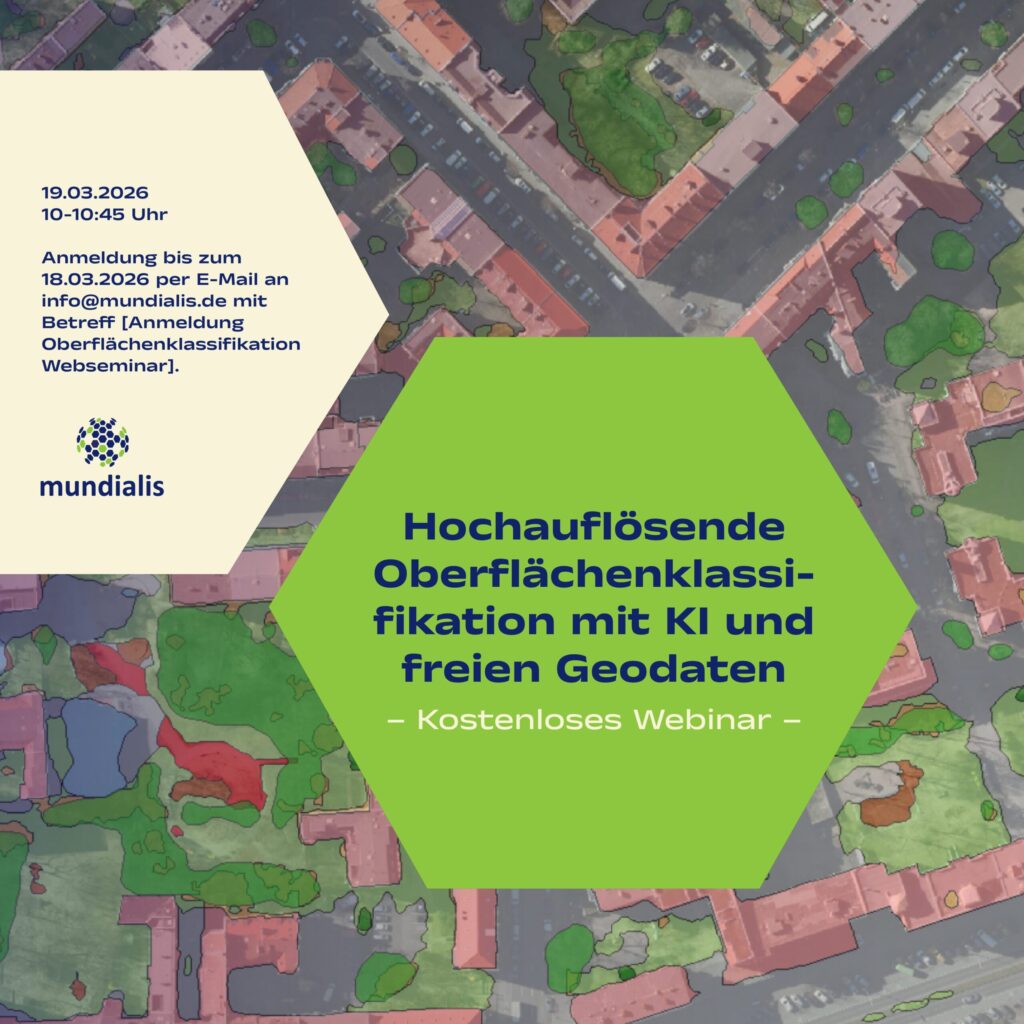
(The webinar will be held in german)We invite you to our webinar, “High-Resolution Surface Classification with AI and Open Geospatial Data – Technology and Application Examples,” on March 19, 2026, from 10:00 to 10:45 AM. What it’s about: In the second part of our impervious surface series, we demonstrate how freely available true orthophotos can […]
Our contributions at the FOSSGIS Conference 2026

Photo: pantherstrix It’s almost that time again: From March 25 to 28, 2026, the FOSSGIS Conference will take place in Göttingen. For us, this community event is something very special: we’re looking forward to exciting presentations, inspiring discussions, and connecting with like-minded people. Of course, we’ll also be actively involved: with several contributions of our […]
Heat Stress Maps – Webinar-recording now online
Extreme heat is becoming an increasing challenge for cities and regions worldwide. In this webinar, we demonstrate how Earth observation (EO) and remote sensing data can be used to systematically assess heat-related risks. Participants will receive a concise overview of relevant data sources, remote sensing methods, and commonly used heat and heat stress indices. Using […]
Projektabschluss: Transformationspotenziale großflächiger Parkplätze

Das vom Bundesinstitut für Bau-, Stadt- und Raumforschung (BBSR) initiierte Forschungsprojekt„Transformationspotenziale großflächiger Parkplätze für den nachhaltigen Stadtumbau“ist abgeschlossen und das Team trifft sich zum Nachklapp. Ziel war es, bislang wenig beachtete Parkplatzflächen systematisch zu erfassen und ihr Potenzial für eine nachhaltige Weiterentwicklung sichtbar zu machen – nicht durch pauschalen Stellplatzabbau, sondern durch qualitative Aufwertung in funktionaler, städtebaulicher […]
A Look Back on 2025
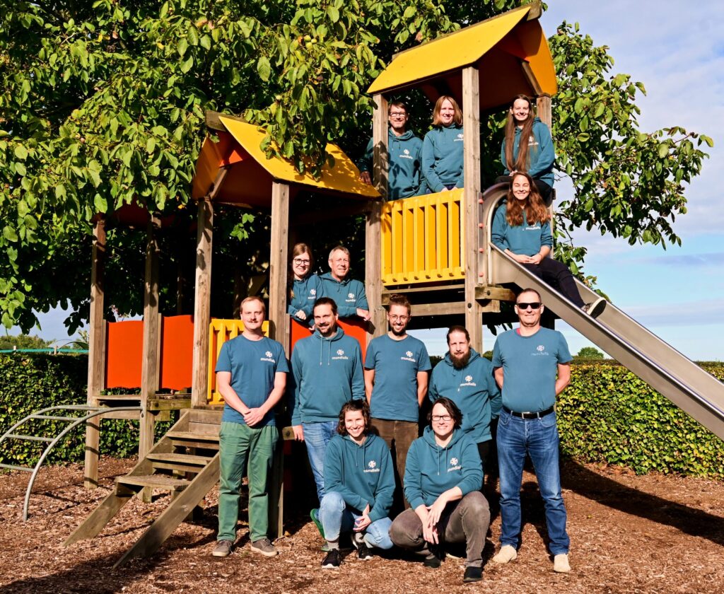
2025 has been a special year for us in many ways—not least because we are celebrating our 10th anniversary. Over this time, our team has grown considerably. Our group photo was taken in September during our retreat in Slenaken—on a playground. And that suits us well: play fosters creativity, collaboration, and well-being, all of which […]
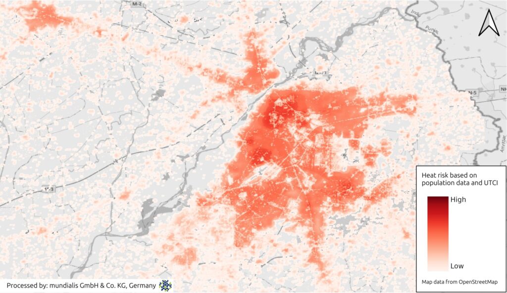
Heat Stress Maps – Webinar Invitation
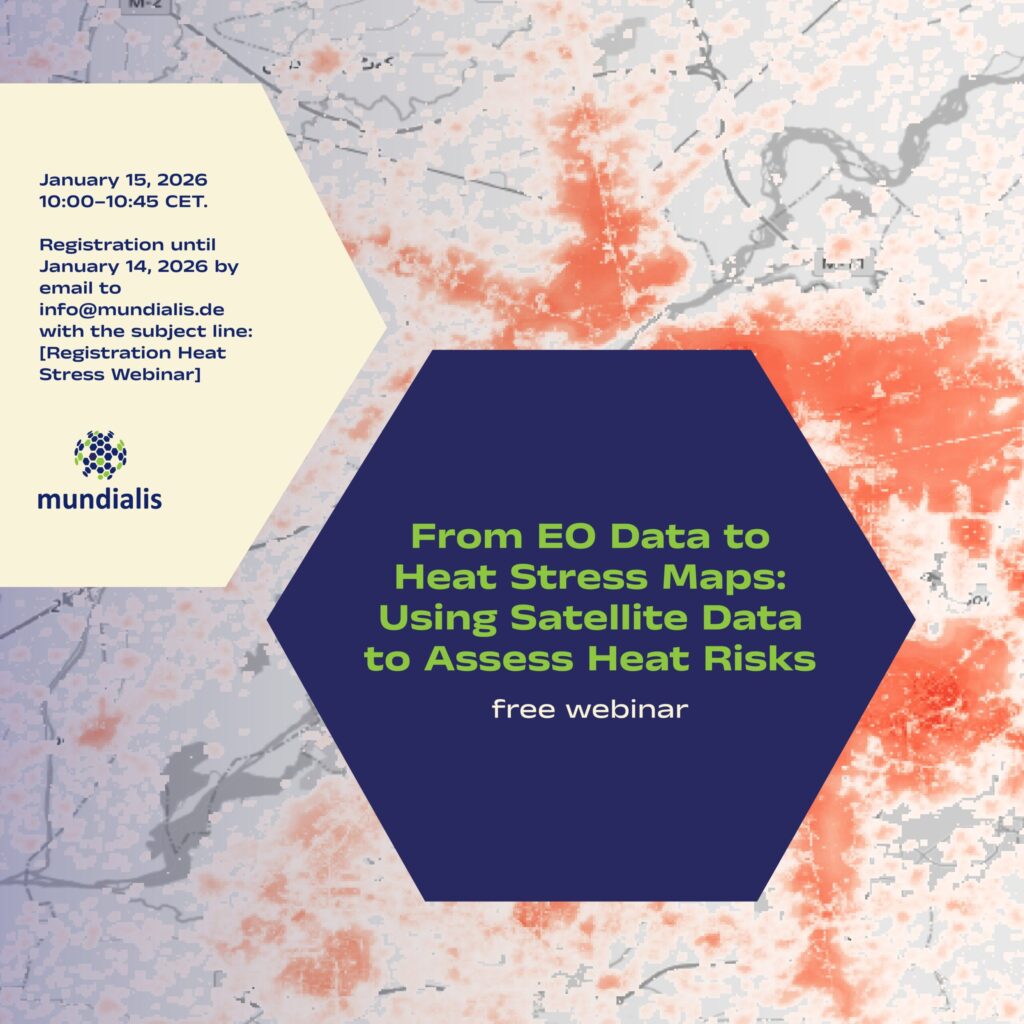
We are pleased to invite you to the online webinar “From EO Data to Heat Stress Maps: Using Satellite Data to Assess Heat Risks” on 15 January 2026, 10:00–10:45 CET. What the webinar is about Extreme heat is becoming an increasing challenge for cities and regions worldwide. In this webinar, we demonstrate how Earth observation (EO) and […]
Satellite Image of the month – December – Berry Islands (Bahamas)
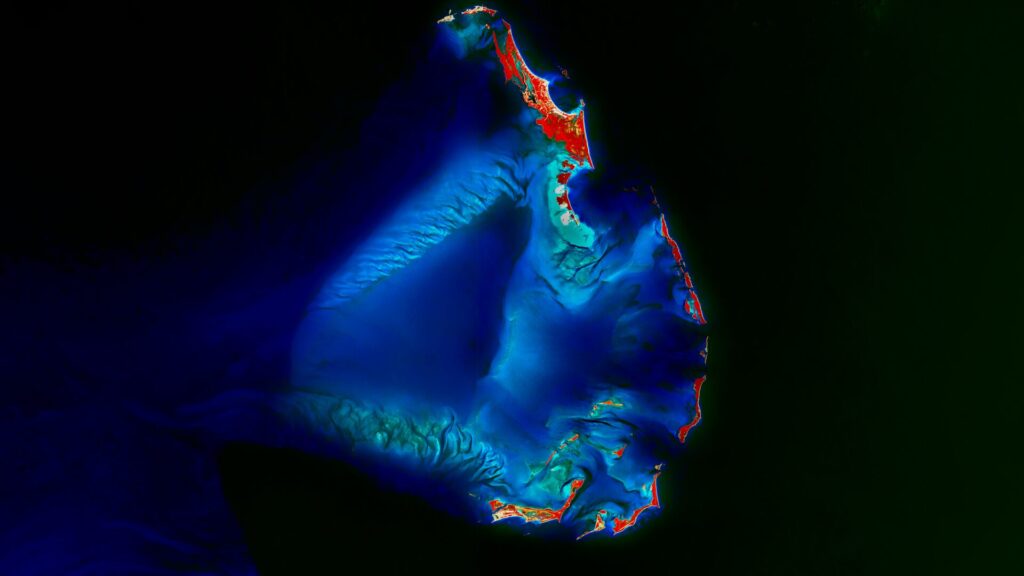
Berry Islands – Bahamas, recorded by the Sentinel-2A satellite on August 1st, 2025 Our Satellite Image of the Month shows the Berry Islands, an island chain belonging to the Bahamas. The chain is located in the northwestern part of the country, specifically north of New Providence Island, which is home to the capital, Nassau. The […]