
Einladung zum Webseminar „KI-gestützte Versiegelungsanalyse”
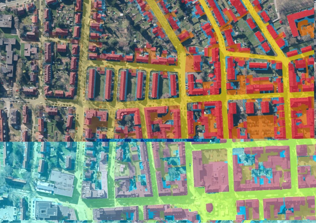
Wir laden Sie und Euch herzlich zum Webseminar „KI-gestützte Versiegelungsanalyse – Flächenversiegelung für die Abwasserwirtschaft“ am 20.11.2025 von 10-10:45 Uhr ein! Darum geht’s: mundialis hat ein flexibles KI-Framework zur Differenzierung von Oberflächenklassen aus frei verfügbaren Luftbildern entwickelt, das wir in zwei Webseminaren vorstellen. Dieser erste Teil beleuchtet ein Praxisbeispiel aus der Abwasserwirtschaft: Wir erläutern unser Vorgehen […]
Waldmonitoring mit Sentinel-2 – Webinar-Aufzeichnung
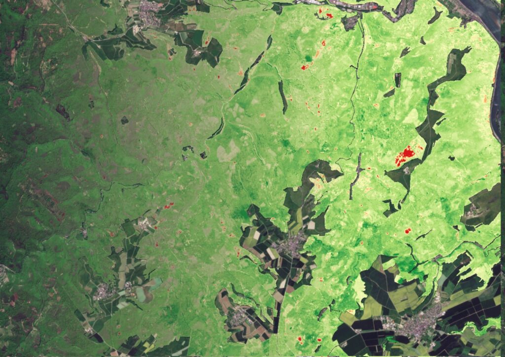
In diesem Webseminar erläutern wir, wie aktuelle Satellitendaten modernes Waldmanagement unterstützen können. Wir zeigen, wie aus Sentinel-2-Daten nutzbare Informationen entstehen, erläutern unsere Analyseverfahren und stellen die eingesetzten Tools vor. Anhand praxisnaher Beispiele erfahren Sie, wie sich Veränderungen erkennen und langfristige Entwicklungen im Wald ableiten lassen. Für alle, die fundierte Einblicke in moderne Monitoring-Methoden und ihre […]
10 Years of mundialis – Looking Back on Open Paths
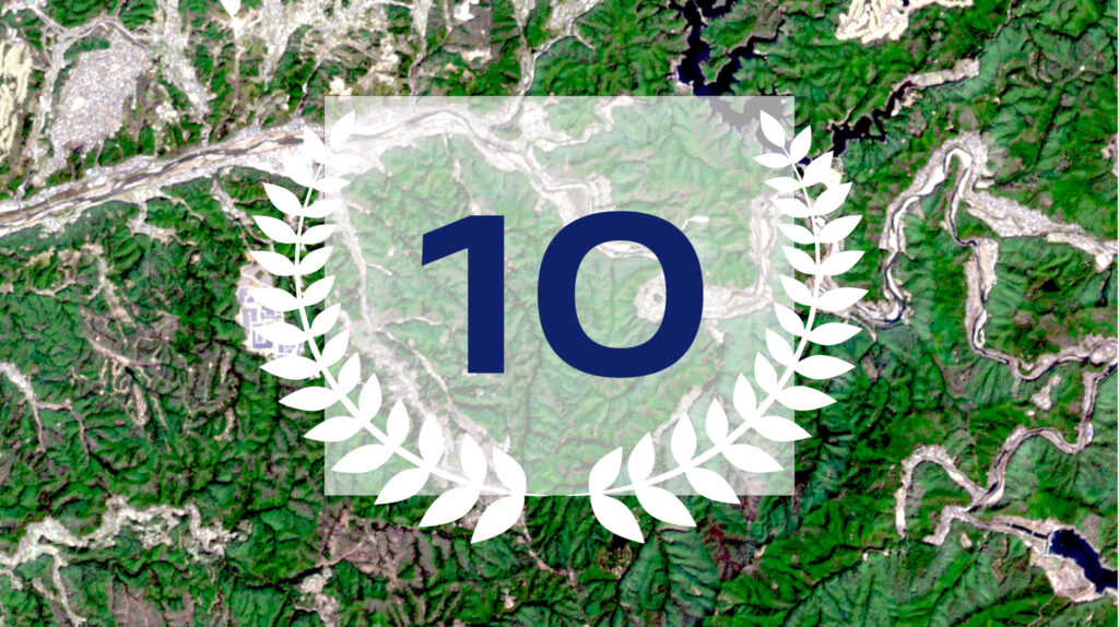
In 2015, we started with the conviction that there are better ways to work with data. Without licensing barriers. Without black boxes. Instead: openness, transparency, and shared learning. We work with data from space, but we keep both feet firmly on the ground.We develop publicly accessible software because we believe that knowledge should be shared. […]
Recap of the Open Day Photogrammetry 2025
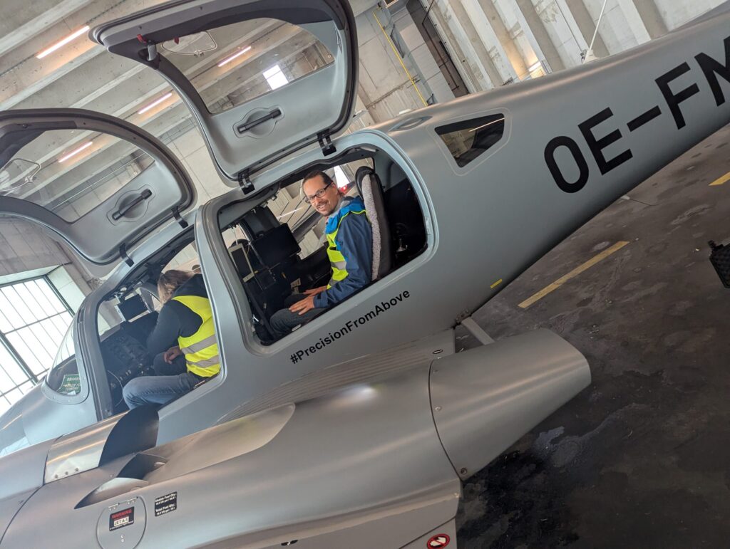
Last week, we had the opportunity to gain fascinating insights into the technology of aerial imaging at this year’s Open Day Photogrammetry at Dortmund Airport – including a close-up look at the specially equipped aircraft regularly used for aerial surveys. As a company that uses aerial imagery as a data foundation, we hosted a workshop […]
Revealing Overlooked Potential, Rethinking Parking Lots – Webinar Recording
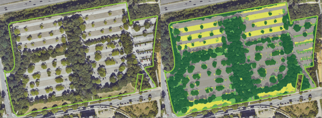
Large-scale parking lots in cities are often overlooked – yet they offer tremendous potential for sustainable urban development, land use, and climate adaptation. In our webinar, we showed how parking areas can be systematically recorded, assessed, and documented – based on open geodata and with the help of open-source software. Thank you all for attending! […]
Back from the 2025 ESA Living Planet Symposium: Three Key Trends for Earth Observation
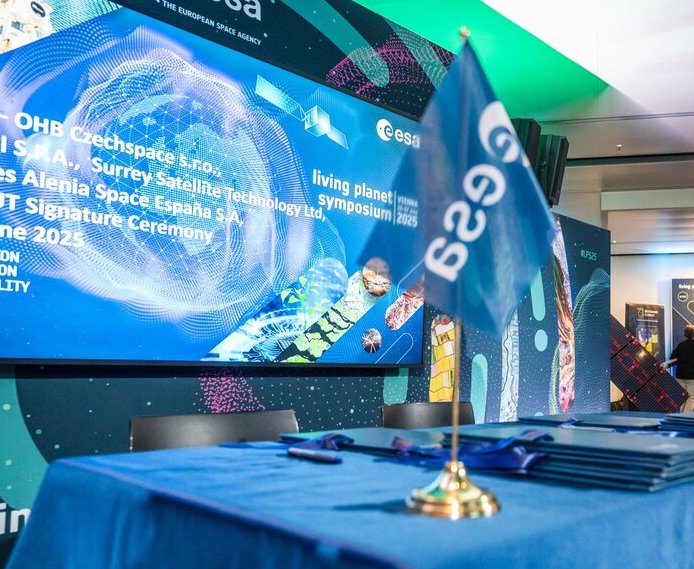
Last week, Vienna became the center of the Earth Observation (EO) world during the ESA Living Planet Symposium 2025, and we at mundialis were proud to be there, contributing and learning alongside global EO leaders. Here are our top three takeaways from the event and how they connect to our daily mission: Copernicus is expanding, […]
GIM International presents: Our Contribution to Climate Adaptation in Cities
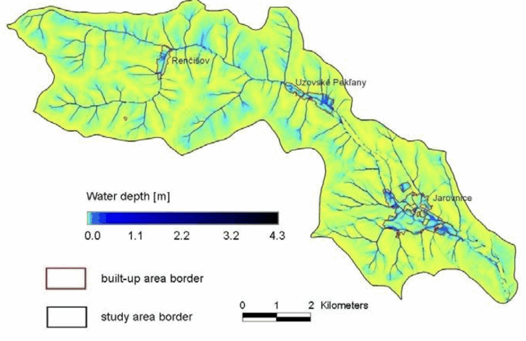
We are pleased that our work has been featured in a recent article by our colleague Markus Metz. The article highlights the growing importance of open-source tools for enhancing climate adaptation — with a focus on our GRASS GIS module r.sim.water. The article explains how climate change is intensifying extreme rainfall events, making cities increasingly vulnerable […]
mundialis at the 26th Bonn Economic Talks
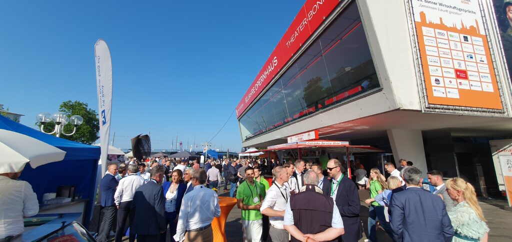
Yesterday, mundialis had the pleasure of participating in the 26th Bonn Economic Talks – an inspiring event under the motto “Shaping the Future Together.” As a company in the field of satellite remote sensing, we contribute to innovation in the region. The Economic Talks provided us with a great opportunity to network with other leaders […]
Parking Lots as a Resource for Sustainable Urban Transformation – Initial Findings
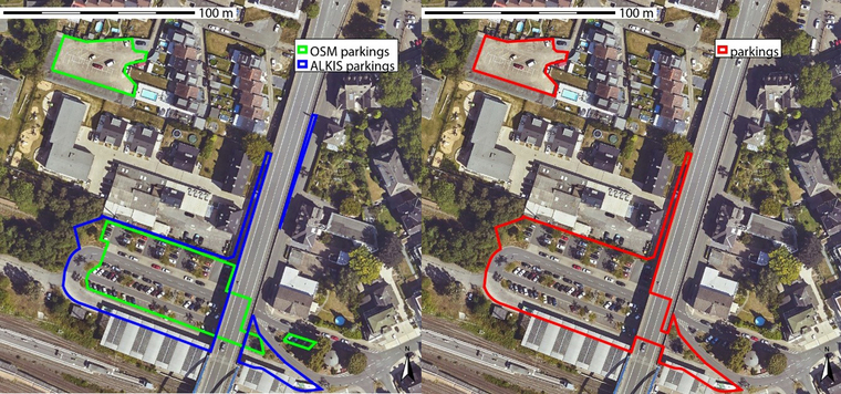
The Federal Office for Building and Regional Planning (BBSR) has published initial results on the transformation of large-scale parking lots – with model cities Dortmund, Görlitz and Ulm. Together with GGR, we have created a data and methodological basis for systematically recording and evaluating parking spaces – with the help of remote sensing, geodata and […]
Einzelbaumerkennung mit offenen Daten der Bundesländer – Webinar-Aufzeichnung
Wie lassen sich offene Geodaten für Umwelt- und Stadtplanung nutzen? Wir zeigen, wie Einzelbäume flächendeckend erfasst werden können – mit Open Source Ansatz und einer Live-Demo. Hier gehts zum Video.