
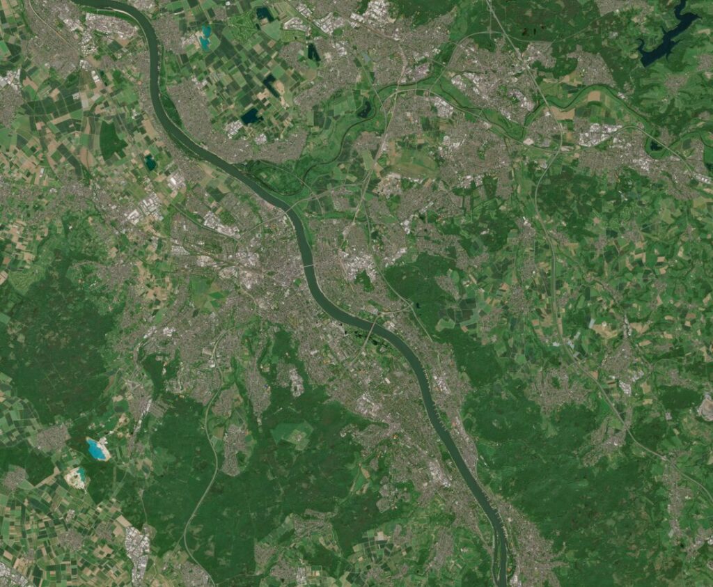
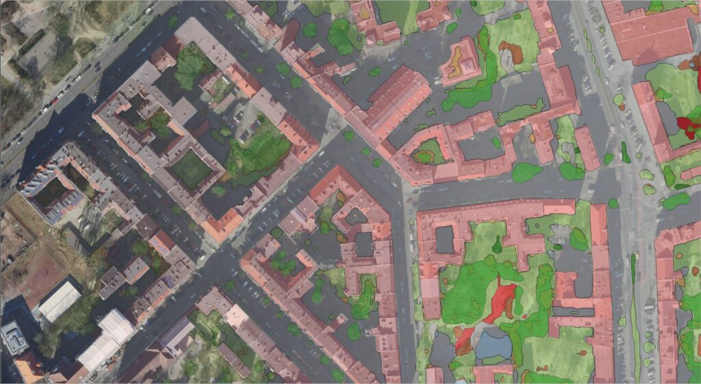
Satellite Image of the Month – July – Düsseldorf (Germany)
The Satellite Image of the Month for July is the seventh part of our twelve-part visual journey. It opens the thematic block “Cities – Urban Green.” The focus is on urban measures as a response to global environmental change: we show how green roofs, trees and urban vegetation can be made visible and analysed using […]
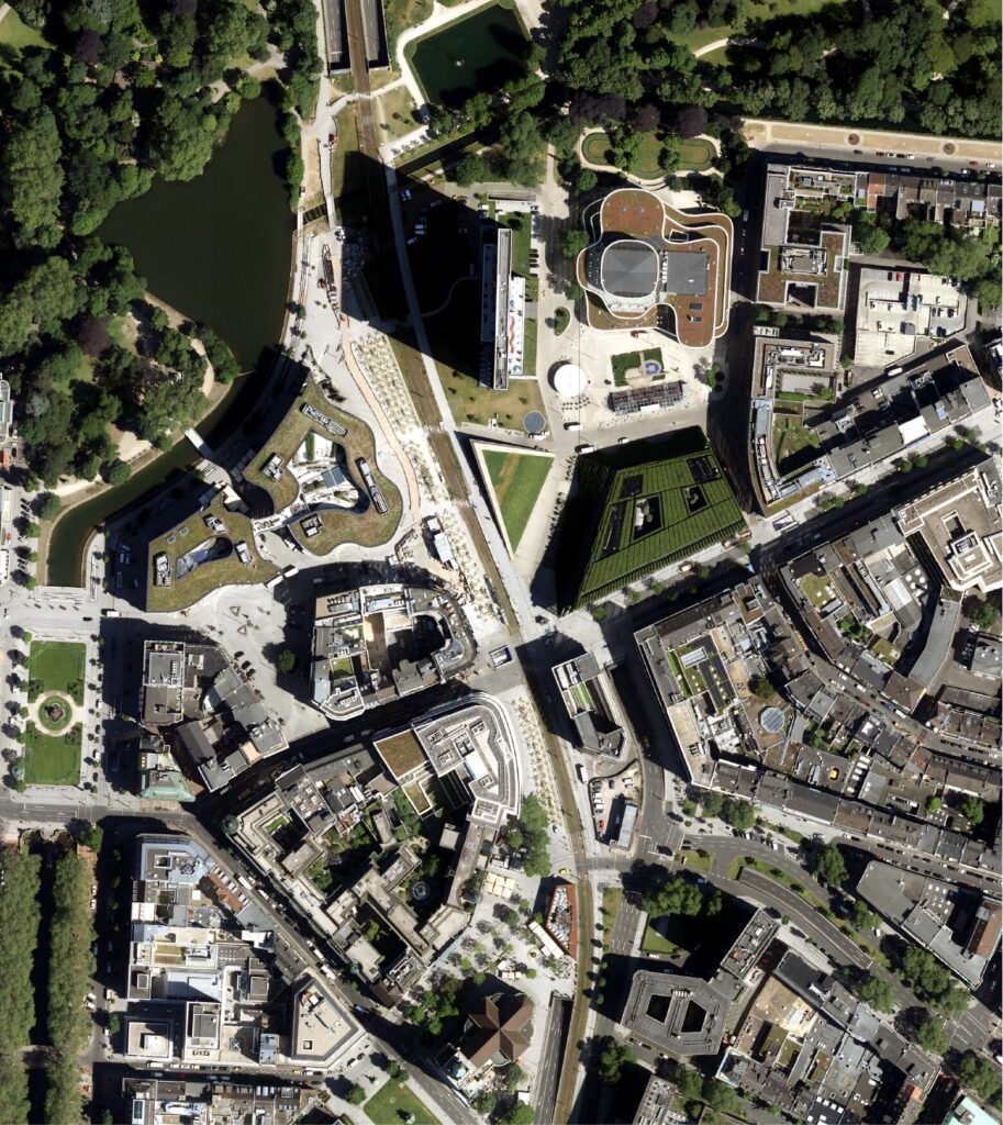
Satellite Image of the Month – June – Stuttgart (Germany)
The orthophoto was acquired on August 11, 2025. The Satellite Image of the Month for June is the sixth part of our twelve-part visual journey. It concludes the thematic section “Traces of Time – Landscapes and Cities in Transition” and introduces the next section, which will focus on urban spaces. The image shows a section of […]
What Satellites Can Tell Us About Our Past – Join Our Webinar
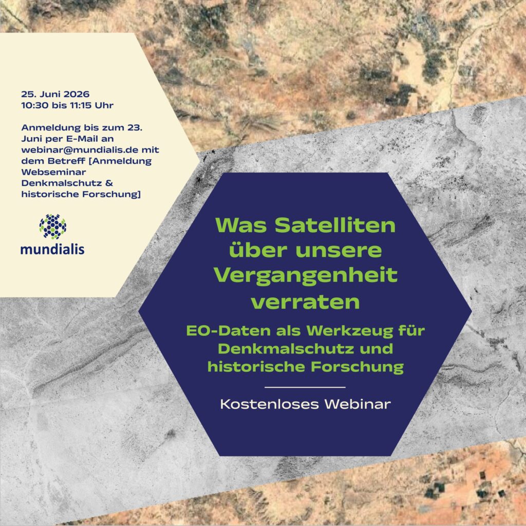
We warmly invite you to our webinar, “What Satellites Reveal About Our Past: Earth Observation Data as a Tool for Heritage Conservation and Historical Research,” taking place on 25 June 2026 from 10:30 to 11:15 a.m. What it’s about: Cultural heritage sites are facing growing challenges from urbanization, land-use change, and increasing environmental risks such […]
Analysis Ready Data – Webinar-recording now online
Sentinel-1 and Sentinel-2 data offer enormous potential for environmental monitoring, land cover analysis, and municipal applications. However, getting started can often seem complex—especially due to preprocessing steps and the variety of data products. In this webinar, we show how Analysis Ready Data (ARD) significantly simplifies access. We provide a practical overview of available ARD offerings […]
Satellite Image of the Month – May – Franconia (Germany)
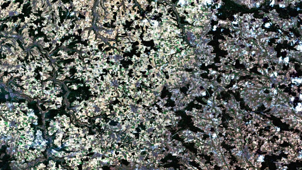
Franconia – Germany, recorded by the Sentinel-2A and -2B satellites on August 14, 2021 and August 14, 2022 The satellite image of the month for May is the fifth image in our twelve-part visual journey. It continues the series ‘Traces of Time – Landscapes and Cities in Transition’, in which we show satellite images to […]
Analysis Ready Data with Sentinel-1 & Sentinel-2 – Invitation to our Webinar
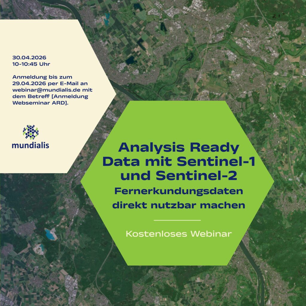
[The Webinar will be held in German]On 30 April 2026, in our webinar, we will show how remote sensing data can be made directly usable with Analysis Ready Data – we warmly invite you to join us. What it’s about: Sentinel-1 and Sentinel-2 data offer enormous potential for environmental monitoring, land cover analysis, and municipal […]
Satellite Image of the Month – April – Harz National Park (Germany)
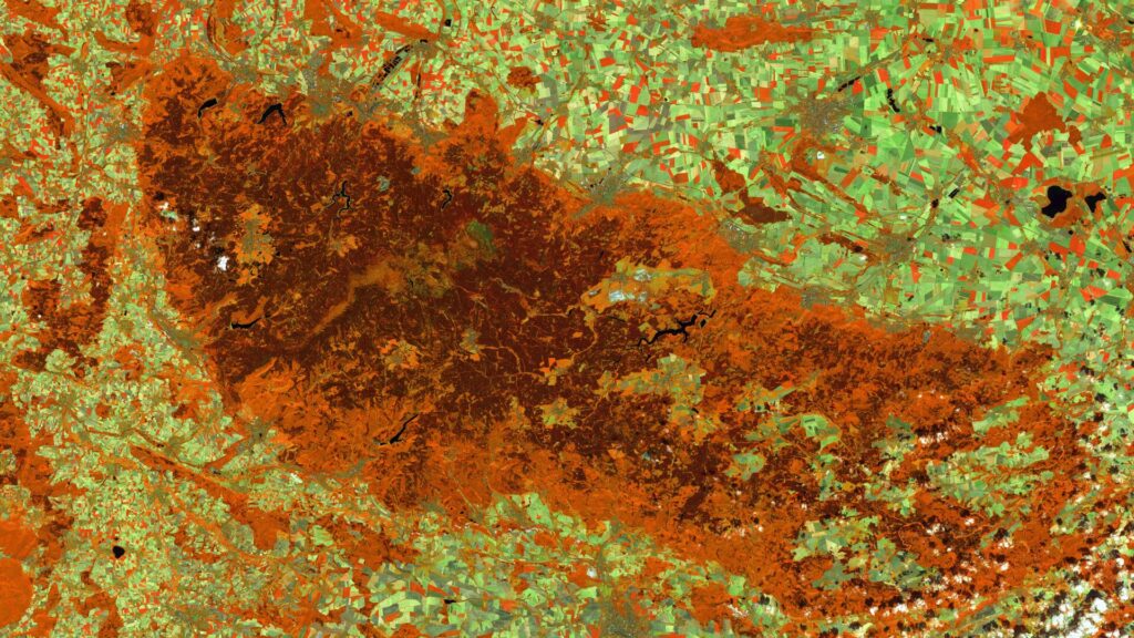
Harz National Park (Lower Saxony/Saxony-Anhalt) – Germany, recorded by the Sentinel-2A and -2C satellites on August 9, 2015 and August 13, 2025 The satellite image of the month April is the fourth image in our twelve-part visual journey and opens the thematic series ‘Traces of Time – Landscapes and Cities in Transition’. Using satellite images, we document and illustrate slower, more gradual changes to the […]
Historical Satellite Data for the Protection of Cultural Heritage
As part of the online lecture series “Spotlight KulturGutSchutz” organized by the Deutsche Gesellschaft für Kulturgutschutz e.V. and Blue Shield Deutschland, we gave a presentation on the use of satellite data in the protection of cultural heritage. The focus was on the question of how historical imagery from U.S. spy satellites from the 1960s can […]
High-resolution surface classification with AI and open geodata – Webinar recording
In the second part of our impervious surface series, we demonstrate how freely available true orthophotos can be transformed into a detailed, high-resolution land cover classification using modern AI architectures. Building on our flexible AI framework, we provide an overview of current AI developments and demonstrate their added value in the semantic segmentation of urban […]
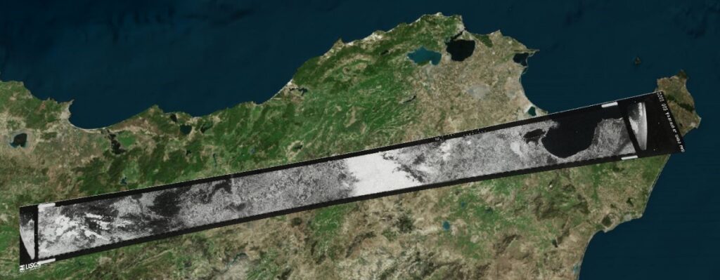
Satellite Image of the Month – March – Rio Grande do Sul (Brazil)
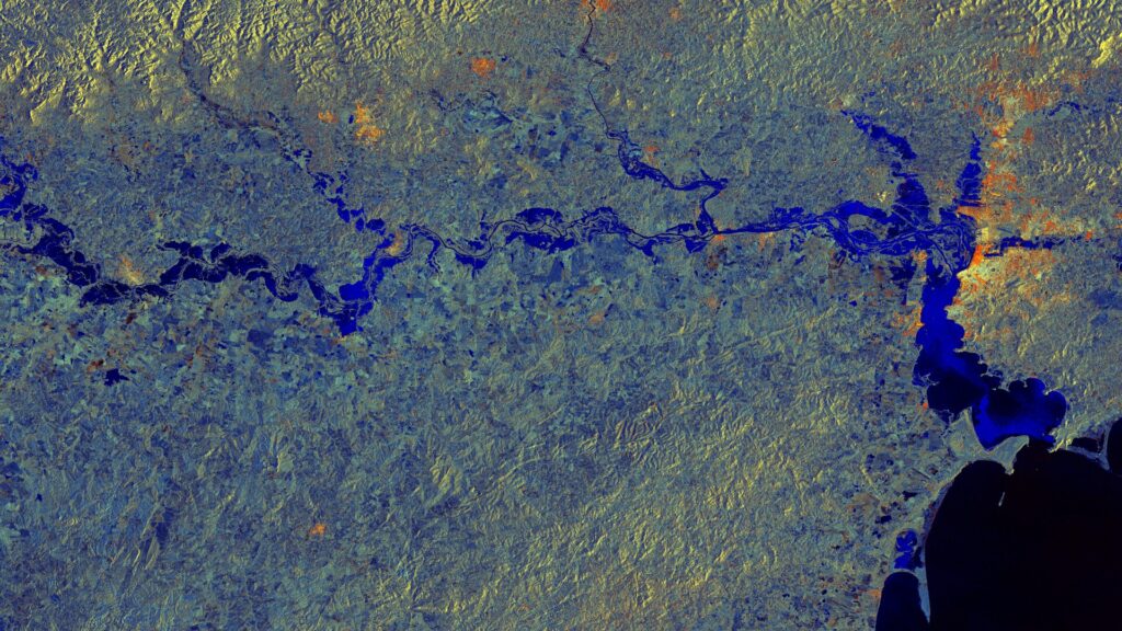
Rio Grande do Sul – Brazil, captured by the Sentinel-1A satellite on May 11, 2024, and June 4, 2024. The satellite image of the month March is the third part of our twelve-part visual journey. It concludes the thematic block “Acute hazards – visible from space”, which deals with natural hazards, their visible impacts and […]